This property has sold. The photographs and notes remain here. See the land currently listed for sale.
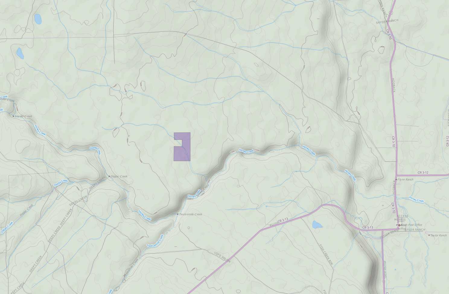
Honey Creek lies below these seventy acres, in a deep ravine that meets Twelvemile Creek. The ground rises gradually above it. A seasonal stream crosses the parcel, and BLM land borders the west.
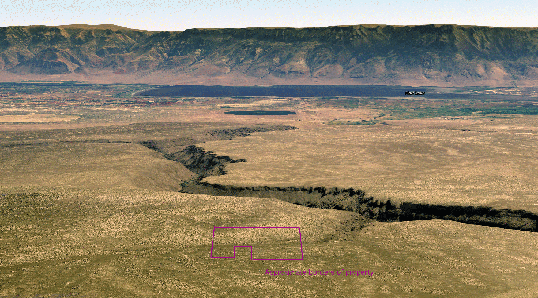
Plush is nearby. Beyond it lie the Warner Lakes and Hart Mountain country, with Lake Abert farther out. The maps give you the scale of it.
The photographs and maps below show the creek country and the parcel's place in it.
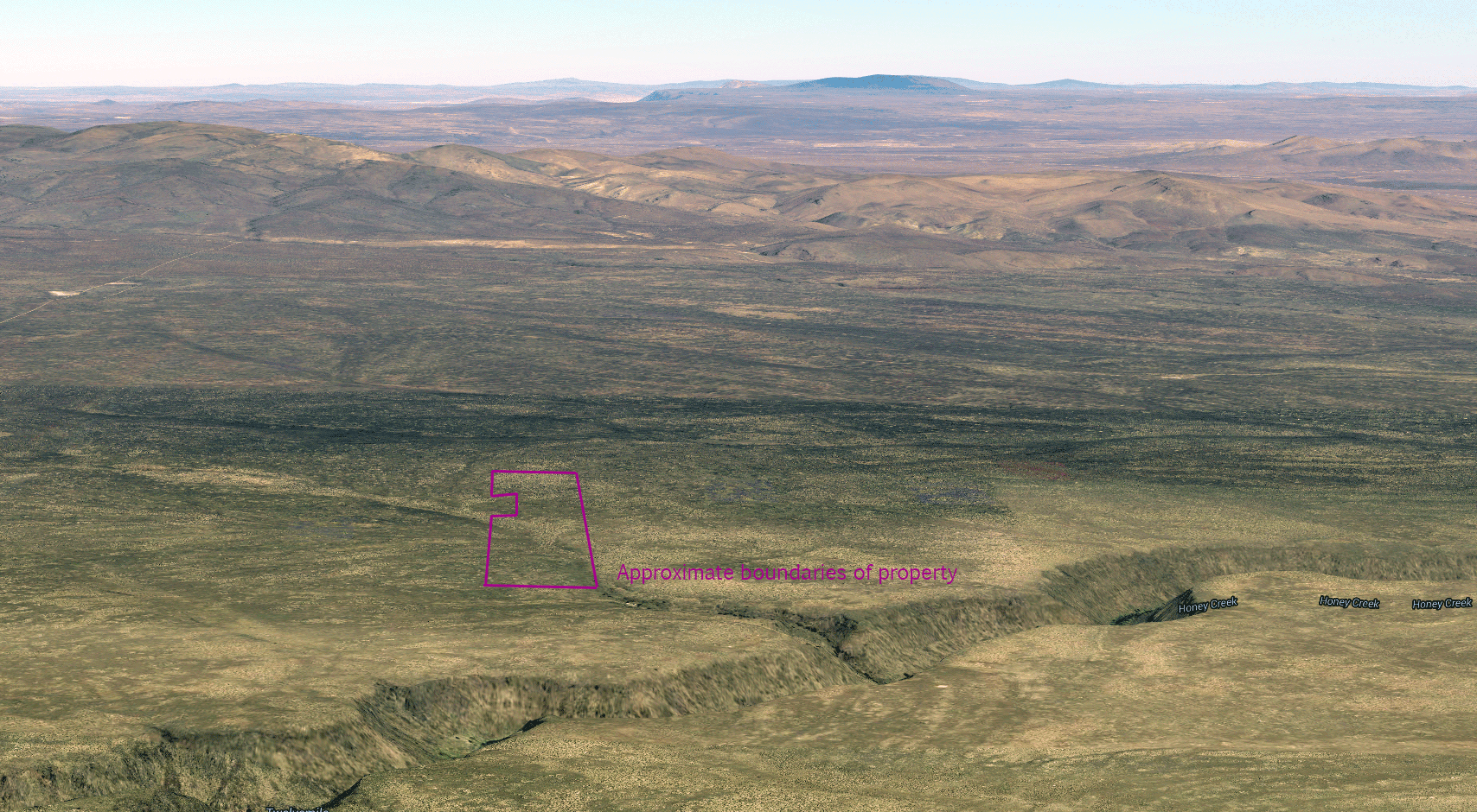
Looking north toward Coyote Hills. The parcel is marked in purple above Honey Creek.
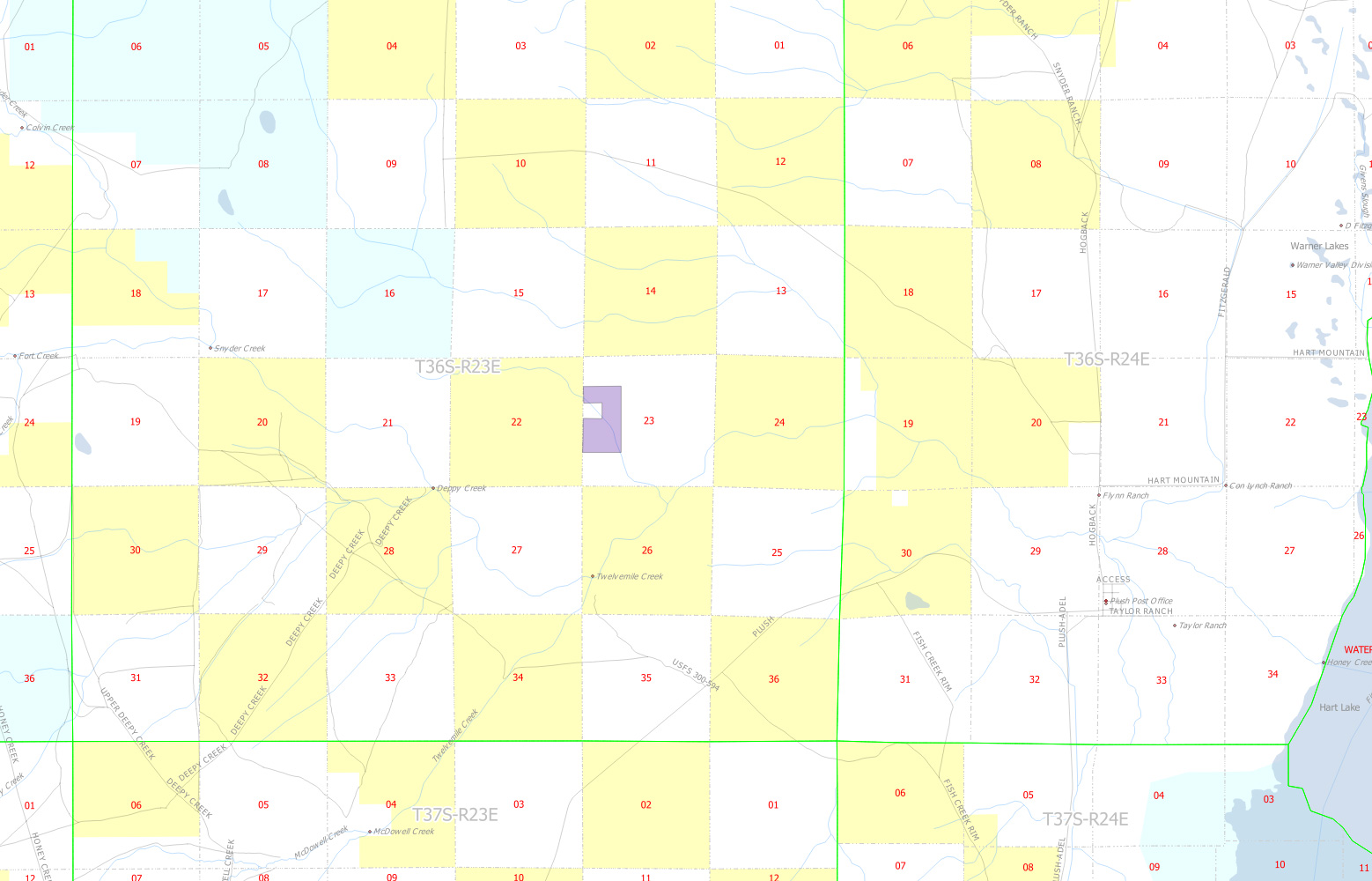
Yellow marks BLM land and turquoise marks state land. Each grid square is one square mile. The parcel borders a square mile of BLM land on the west.

Looking east toward Hart Mountain, the Warner Wetlands, and Plush.
What's the legal description?
36S 23E WM section 23 tax lot 900. The section plat shows the parcel, one of the larger holdings in the section, and the seasonal stream.
Why is it shaped so strangely?
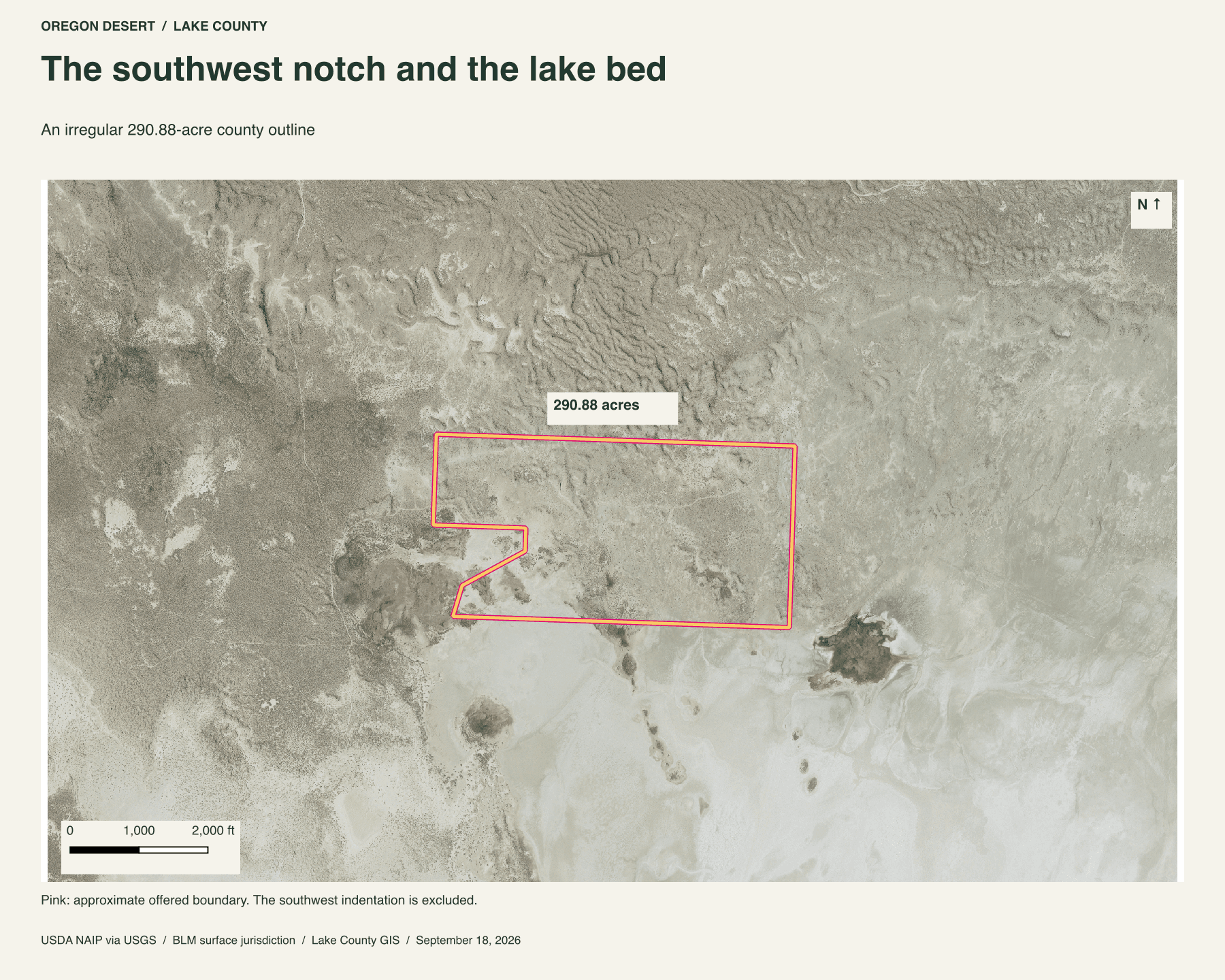
I don't know. My guess is that the subdivider wanted several parcels to touch the BLM land on the west. That's a guess about the shape, not a record of why it was divided this way. A public-land boundary alone doesn't establish legal access.
Are there roads to the property?
Dirt roads lead to the property. Lava rock makes some stretches rough, and four-wheel drive is probably needed. Spring can leave the road muddy.
How long does it take to drive there?
Listed drive estimates are 4 hours from Bend, just under 5 hours from Reno, and a little over an hour from Lakeview. Allow for the road conditions.
Is it accessible all year?
Probably, when the roads are passable. Rain can bring mud. Snow rarely lasts, but winters can be very cold.
What's the elevation?
5,200 feet above sea level.
Buyer due diligence
Before you buy
These listings and maps do not grant permission to enter any property or cross neighboring land. Visits to land offered for sale must be arranged with Peter in advance and use an authorized route. A sold listing is not an invitation to visit its current owner's land.
Buyers must independently verify recorded legal access and easements, road conditions and maintenance, water availability and water rights, well feasibility, power and other utilities, septic suitability, boundaries, title restrictions, and mineral rights.
Confirm zoning, permits, and whether your intended use is allowed with the county and relevant agencies, including building a home, camping, RV use, or renting to guests. Check flood and wetland restrictions and the cost of any improvements. A visible road, nearby power line, or mapped water does not establish a right to use it. Listing descriptions and maps are for general information and do not guarantee access, services, boundaries, or permission to build. Consult the county, utility providers, a title company, and qualified professionals before committing to a purchase.