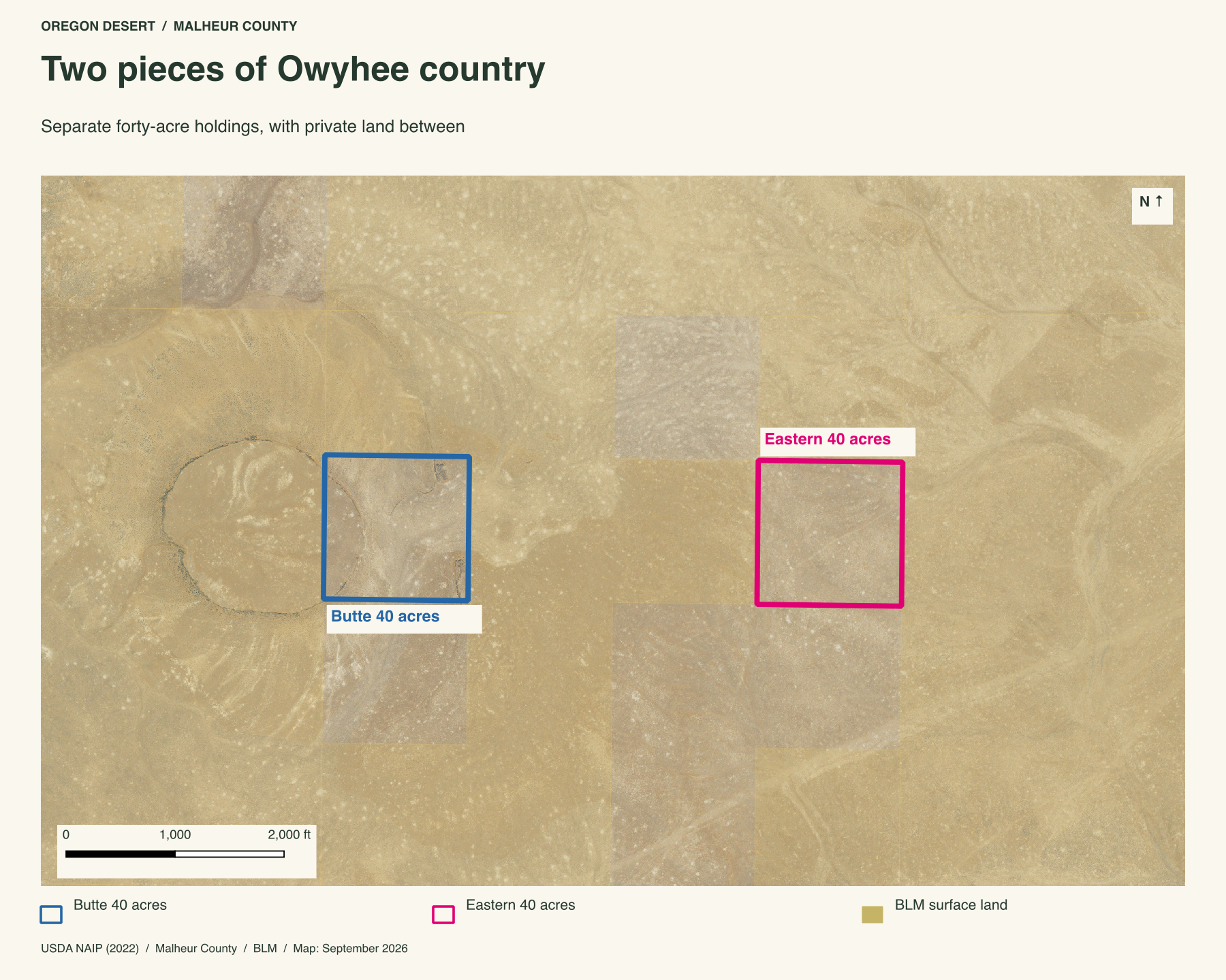
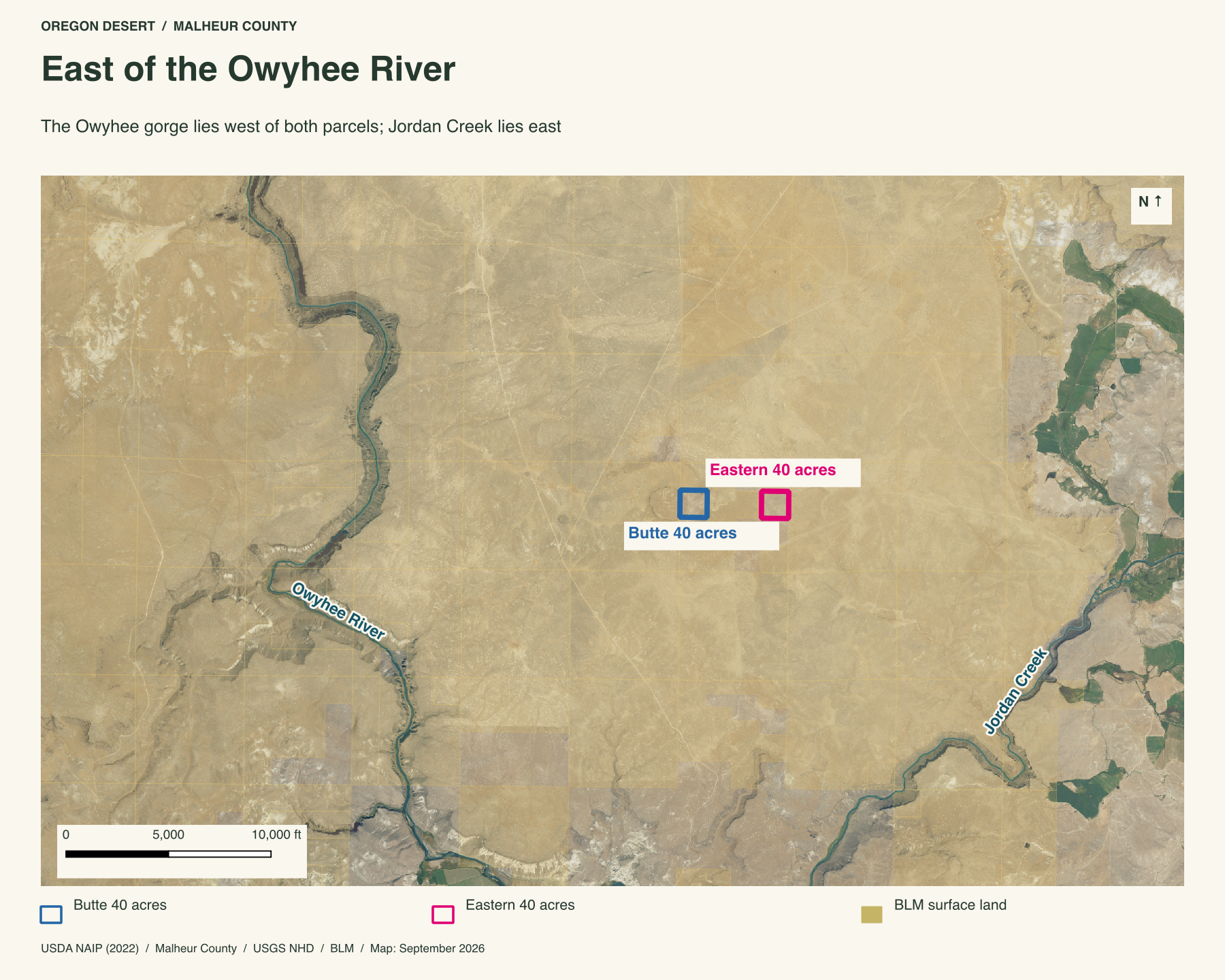
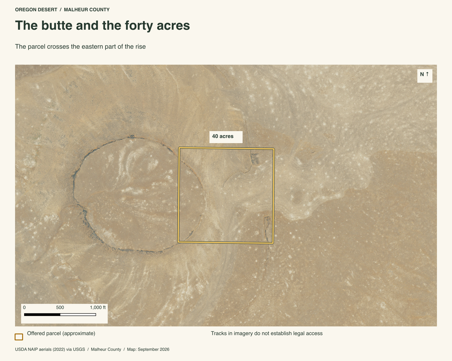
Forty acres on the eastern part of Little Owyhee Butte, about 2.8 miles east of the Owyhee River. The river winds through a steep gorge west of this sagebrush plateau. Rimrock and a rounded shoulder give the butte a shape you can recognize. The larger rise continues beyond the parcel to the west.
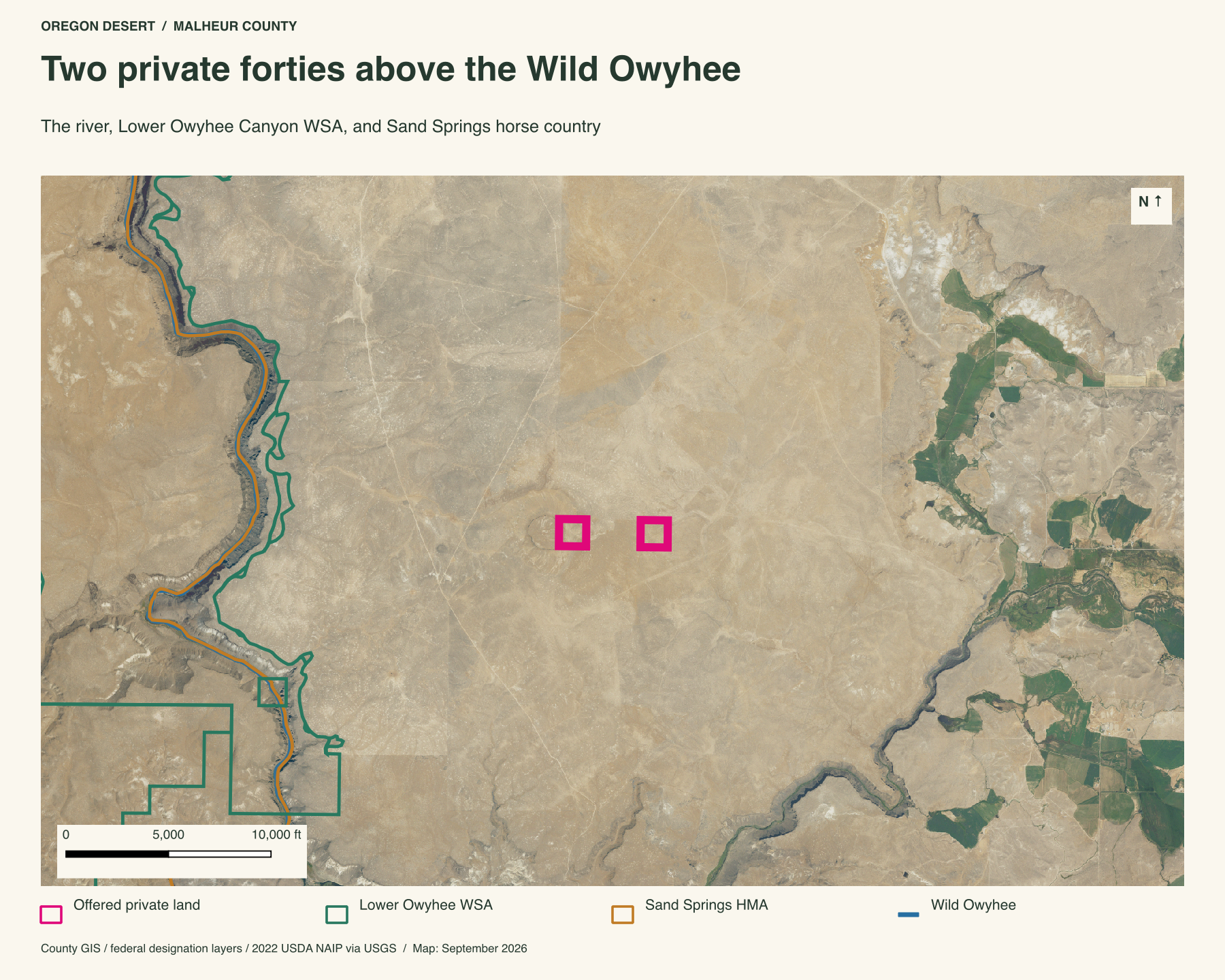
Another forty acres east of Little Owyhee Butte is also for sale. The two mapped boundaries are about half a mile apart in a straight line, with another private parcel between them. They are separate holdings and can be bought together.
BLM land fills much of the country around these private parcels. That is part of owning a piece of this butte: you have your own high ground, while the surrounding plateau and the Owyhee gorge remain a much larger landscape to explore. The maps show the private gaps as well as the public ground.
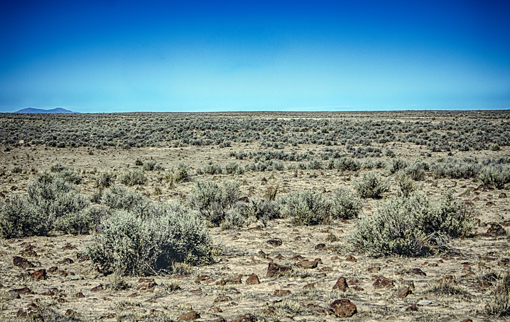
Rock and sagebrush underfoot
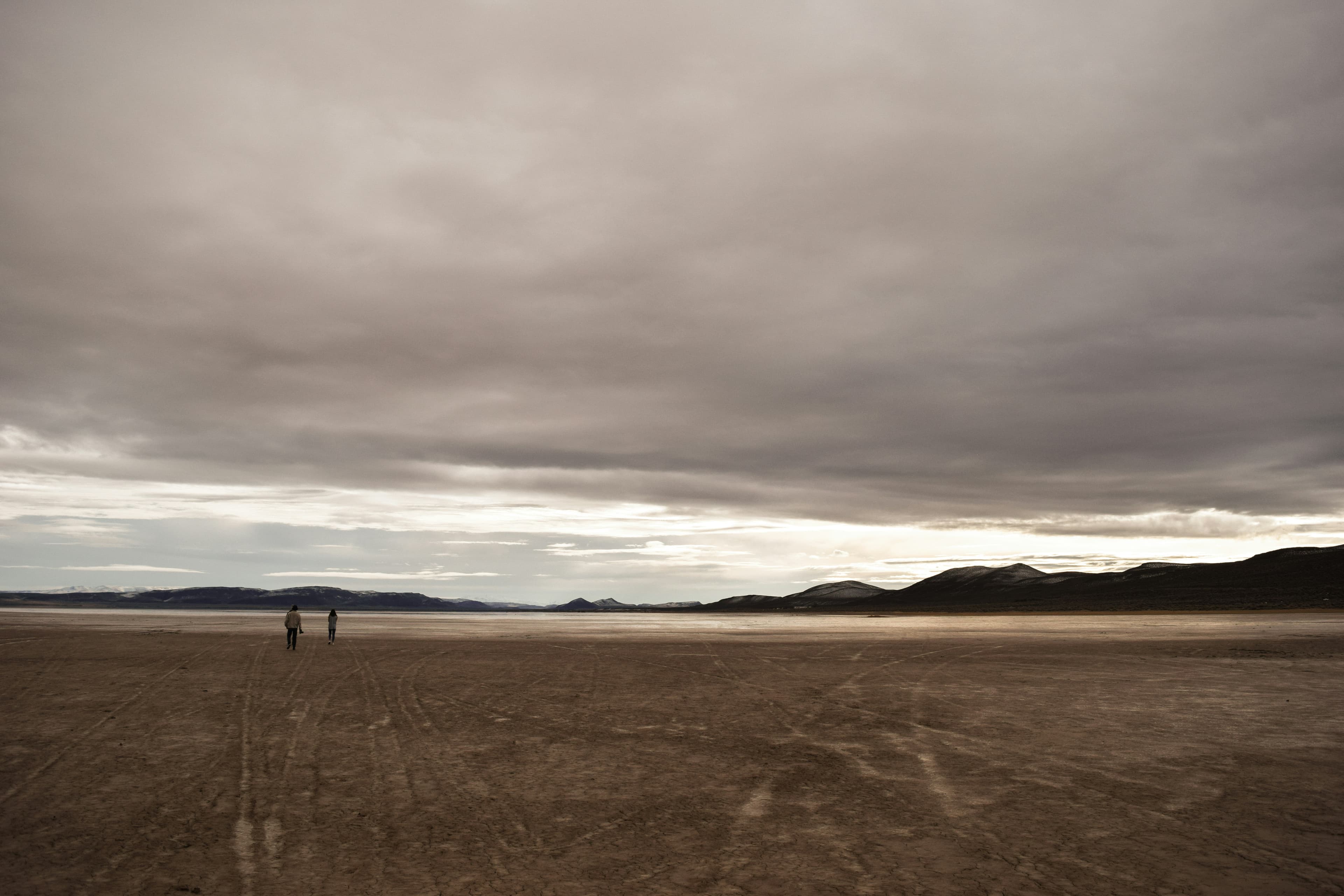
At ground level, the country opens into sagebrush with scattered rock between the plants. These early-fall photographs bring the aerial view down to the texture of the ground and the hills on the horizon.

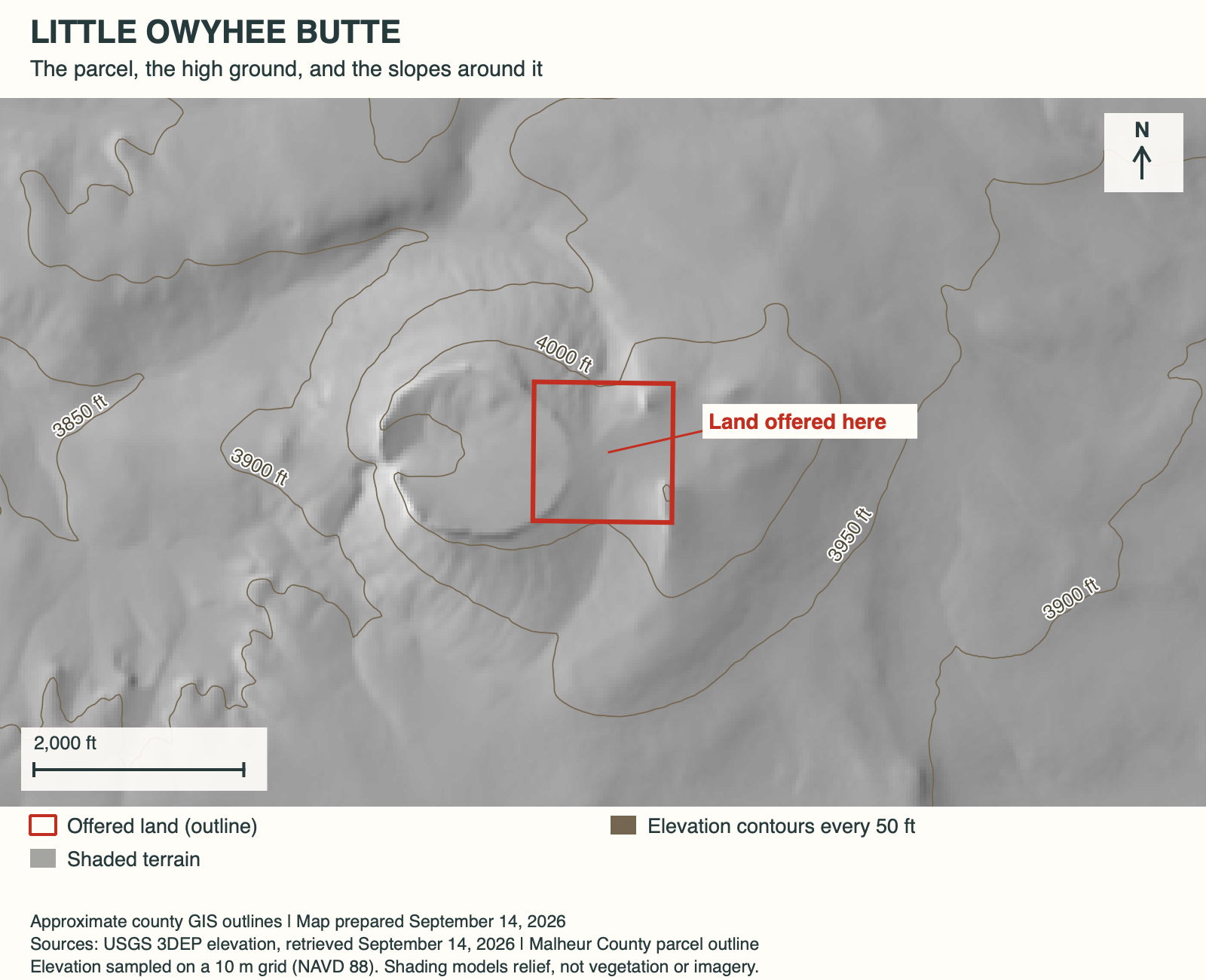
How the forty acres sit on the butte
The interest in this holding is the change in elevation. Slopes and rock edges break up the forty acres, while the rounded rise continues west beyond the boundary. The contour map makes that shape easier to follow than a view through sagebrush.
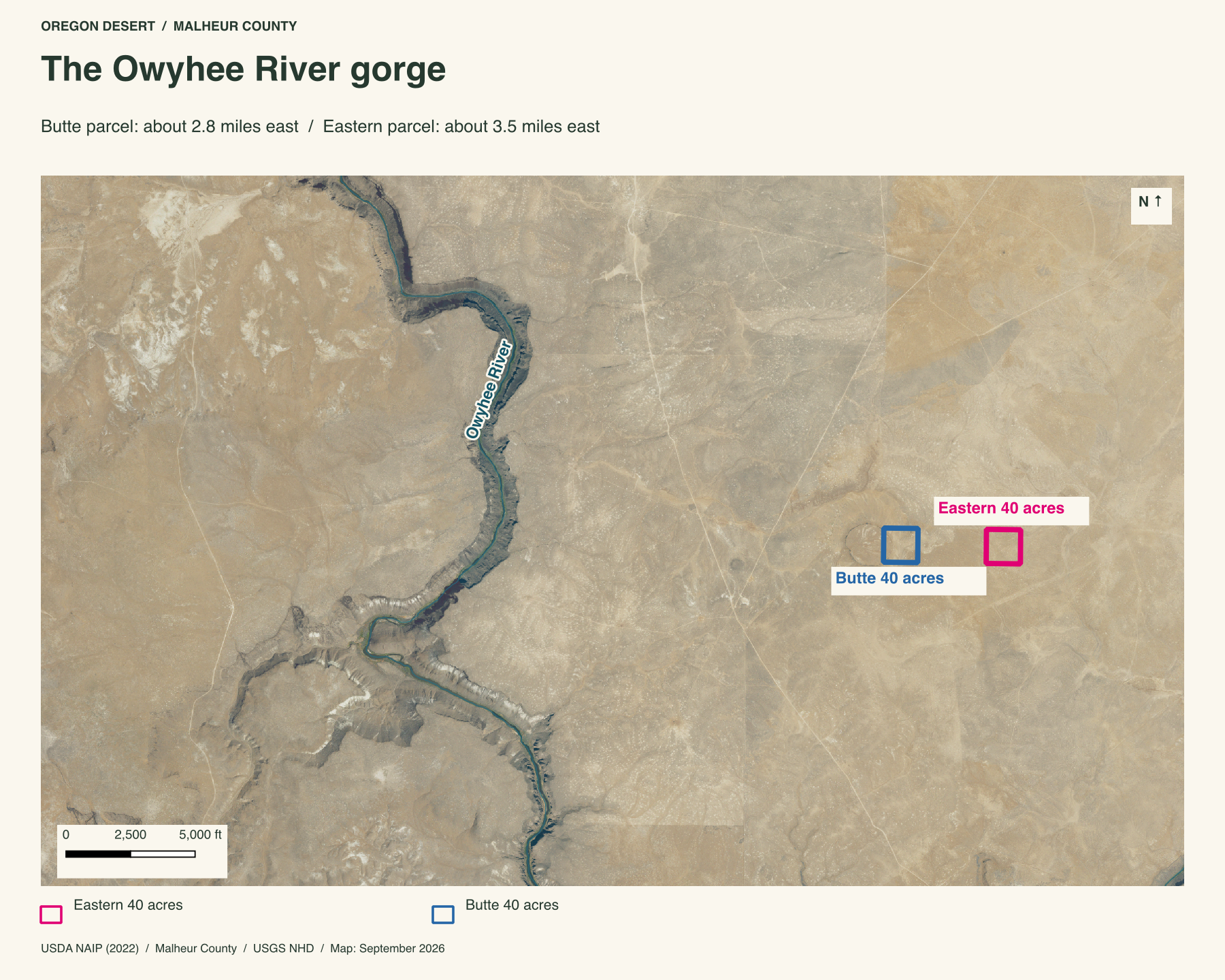
The Owyhee gorge to the west
West of the butte, the plateau breaks into the Owyhee River gorge. The aerial view follows tight bends between bare canyon walls and a narrow strip of green along the water. The nearest mapped river channel is about 2.8 miles from the parcel boundary in a straight line. Jordan Creek is the separate watercourse east of the property.
Wild river, canyon WSA, and horse country
The gorge west of the butte is part of the Wild and Scenic Owyhee River. The nearest river reach is about 2.8 miles from this parcel. The Lower Owyhee Canyon Wilderness Study Area begins about 2.4 miles away, and BLM's Sand Springs wild-horse range begins about 2.8 miles west. This is private high ground at the edge of a protected river canyon and a 192,524-acre horse range.
For a broader look at the canyonlands, see ONDA's Owyhee Canyonlands guide and BLM's Lower Owyhee Canyon WSA map.
Sweetwater Canyon and Weeping Wall Springs
The river west of the property runs through Sweetwater Canyon. Its walls tell a story that is hard to see from the plateau. In their Sweetwater Canyon field guide, Ken Giles and geologist Kyle House describe a canyon cut roughly 450 feet through lava and softer sediment. The dark rimrock is a stack of thin lava flows. Pink bands beneath it mark wet sediment baked by the arriving lava. Farther down the canyon, a collapsed section of rimrock once dammed the river. Debris left after that dam failed forms Bullseye Rapid.
Downstream of Sweetwater, Weeping Wall Springs emerge on the west side of the river near Granite Creek. BLM marks the springs between river miles 17 and 18 on its Owyhee river map, measured downstream from Rome. Springs against the canyon wall are a different side of the dry country visible from above.
Ryegrass hot springs and the pale cliffs of Chalk Basin
Farther north, Ryegrass is known for hot springs beside the river. The Ryegrass river landmark is about 10 miles north of the parcel in a straight line, one of several strange places waiting downriver.
Just beyond Ryegrass, the river passes Pruitt's Castle and Lambert Dome into Chalk Basin. Pale lake sediments, dark lava and red baked layers stand above the water. BLM's Chalk Basin and Lambert Rocks map explains the contrast. The pale beds formed in an ancient lake. Later lava entering from the east blocked the Owyhee and forced it to cut a new course around the rock to the west.
Stone walls and an old waterwheel at Birch Creek
For a farther-downriver outing, Birch Creek Historic Ranch is about 21 miles northeast of the parcel in a straight line. Basque stone walls climb the mesa. Waterwheel remnants recall the work of lifting river water to irrigate fields in the canyon. The early-1900s ranch retains 19 historic buildings and structures. BLM identifies May through October as the best access season, with road conditions deciding whether the approach is passable.
Rome to Birch Creek is about 50 river miles, with whitewater and a season governed by snowmelt. Start with BLM's Owyhee river information and boating guide when planning a trip.
What's the legal description?
30S 41E WM section 25 tax lot 800.
Is there power to the property?
No. The property is off the power grid.
What should a buyer know about the approach?
The surrounding dirt roads cross rocky ground and can become muddy after rain. Ask Peter about current conditions when arranging a visit.
What's the elevation?
4,040 feet above sea level.
How big is 40 acres?
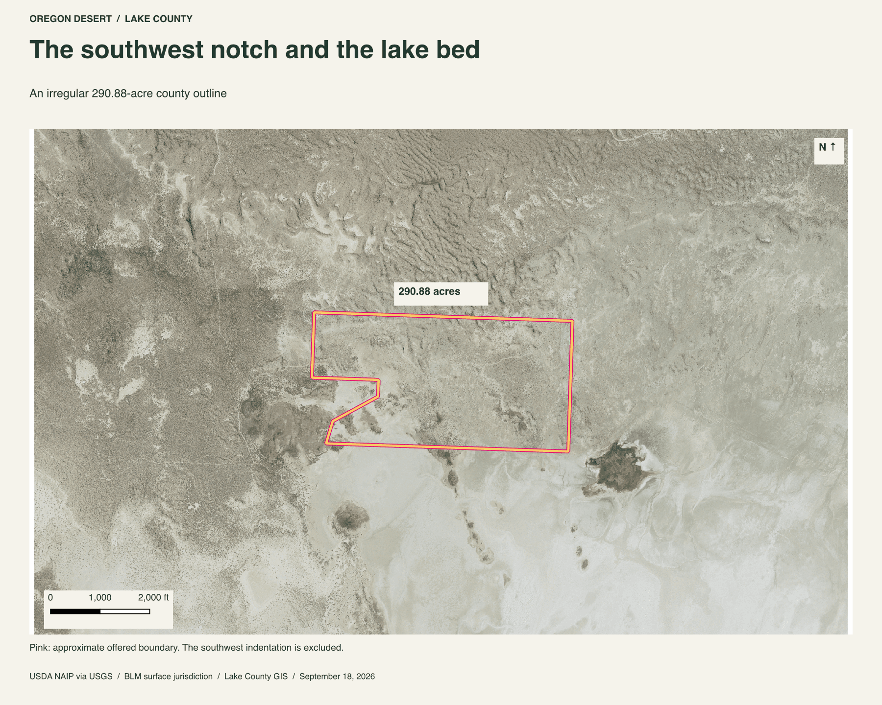
A square forty-acre parcel is roughly a quarter mile on each side. The county outline shows how this holding lies across the butte.
Property taxes and county records
Malheur County account 11762
- Acreage
- 40 acres
- County parcel reference
- 30S41 800
- Discounted annual tax
- $65.17
- Record last updated
- 2025
Buyer due diligence
Before you buy
These listings and maps do not grant permission to enter any property or cross neighboring land. Visits to land offered for sale must be arranged with Peter in advance and use an authorized route. A sold listing is not an invitation to visit its current owner's land.
Buyers must independently verify recorded legal access and easements, road conditions and maintenance, water availability and water rights, well feasibility, power and other utilities, septic suitability, boundaries, title restrictions, and mineral rights.
Confirm zoning, permits, and whether your intended use is allowed with the county and relevant agencies, including building a home, camping, RV use, or renting to guests. Check flood and wetland restrictions and the cost of any improvements. A visible road, nearby power line, or mapped water does not establish a right to use it. Listing descriptions and maps are for general information and do not guarantee access, services, boundaries, or permission to build. Consult the county, utility providers, a title company, and qualified professionals before committing to a purchase.