The northern edge of the basin
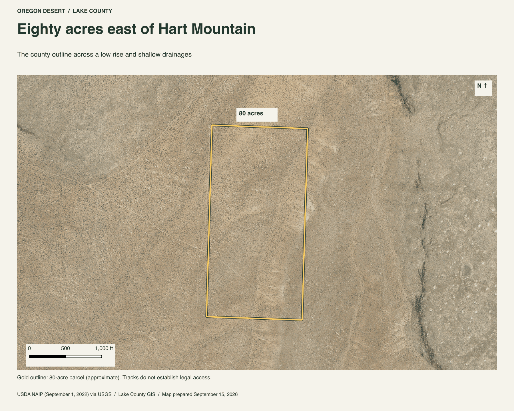
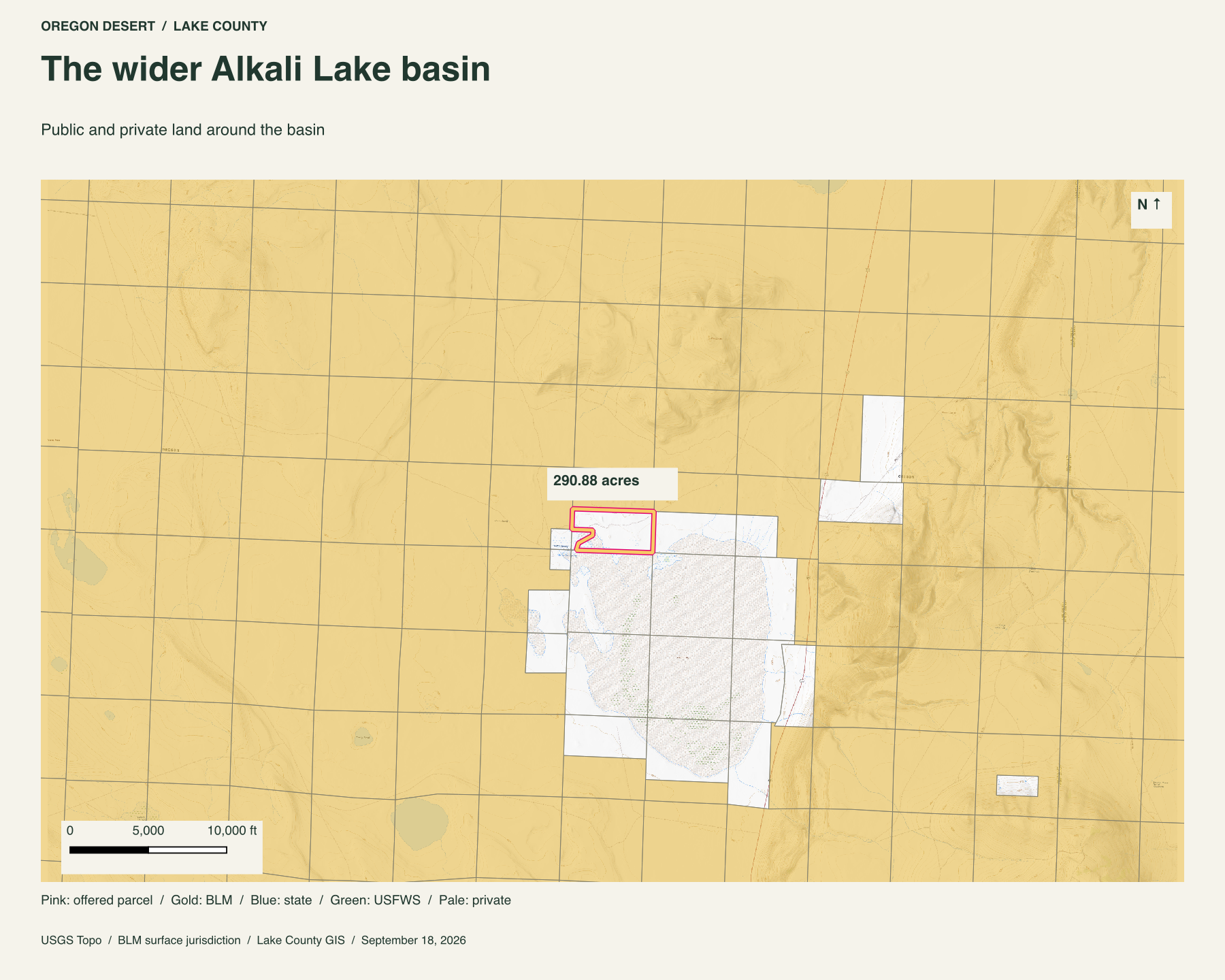
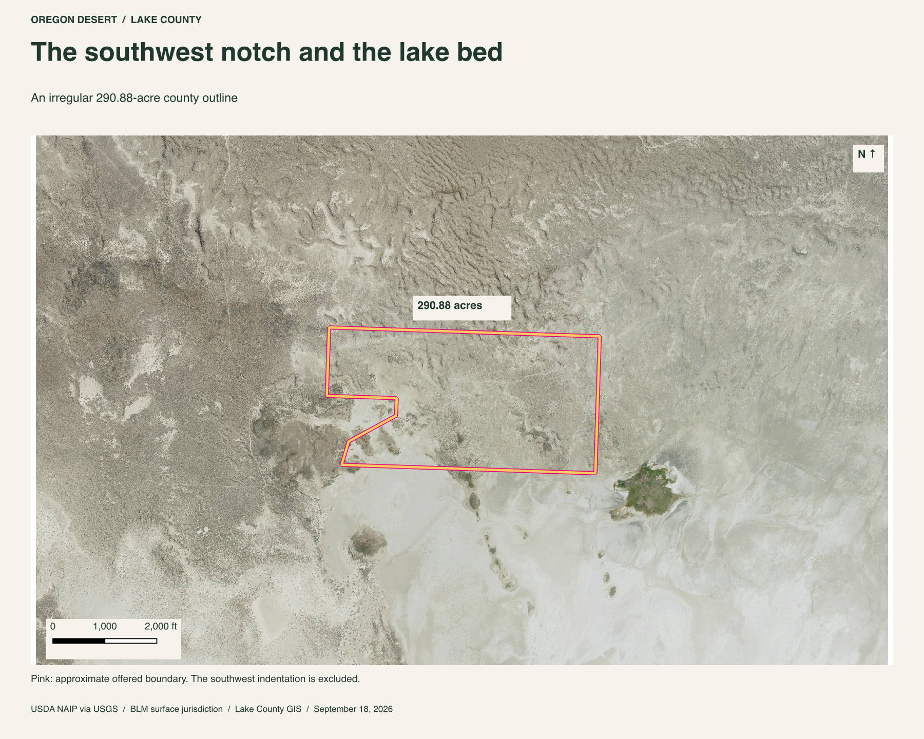
The county outline reaches from sagebrush ground toward the pale edge of Alkali Lake. BLM land is mapped to the north and west. Private ground makes the lakeward boundary and the notch in the southwest corner. The maps show that pattern without turning neighboring land into part of this offer.
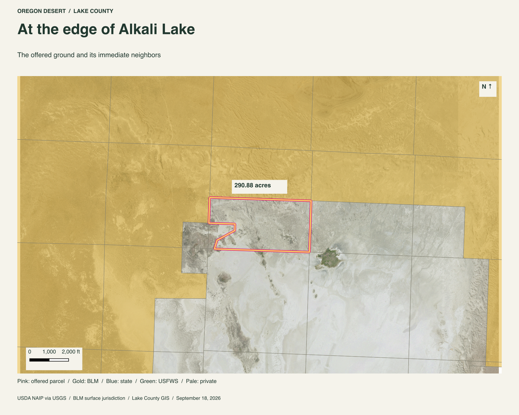
Here is a long strip of the Oregon high desert to call your own. It runs roughly a mile east to west, and about half a mile down its eastern side. The southern edge meets the lighter ground of the lake basin. The northwest stays on darker, textured ground. Its shape gives you both, with a bite of neighboring land cut from the southwest corner.
A lake bed with a long history
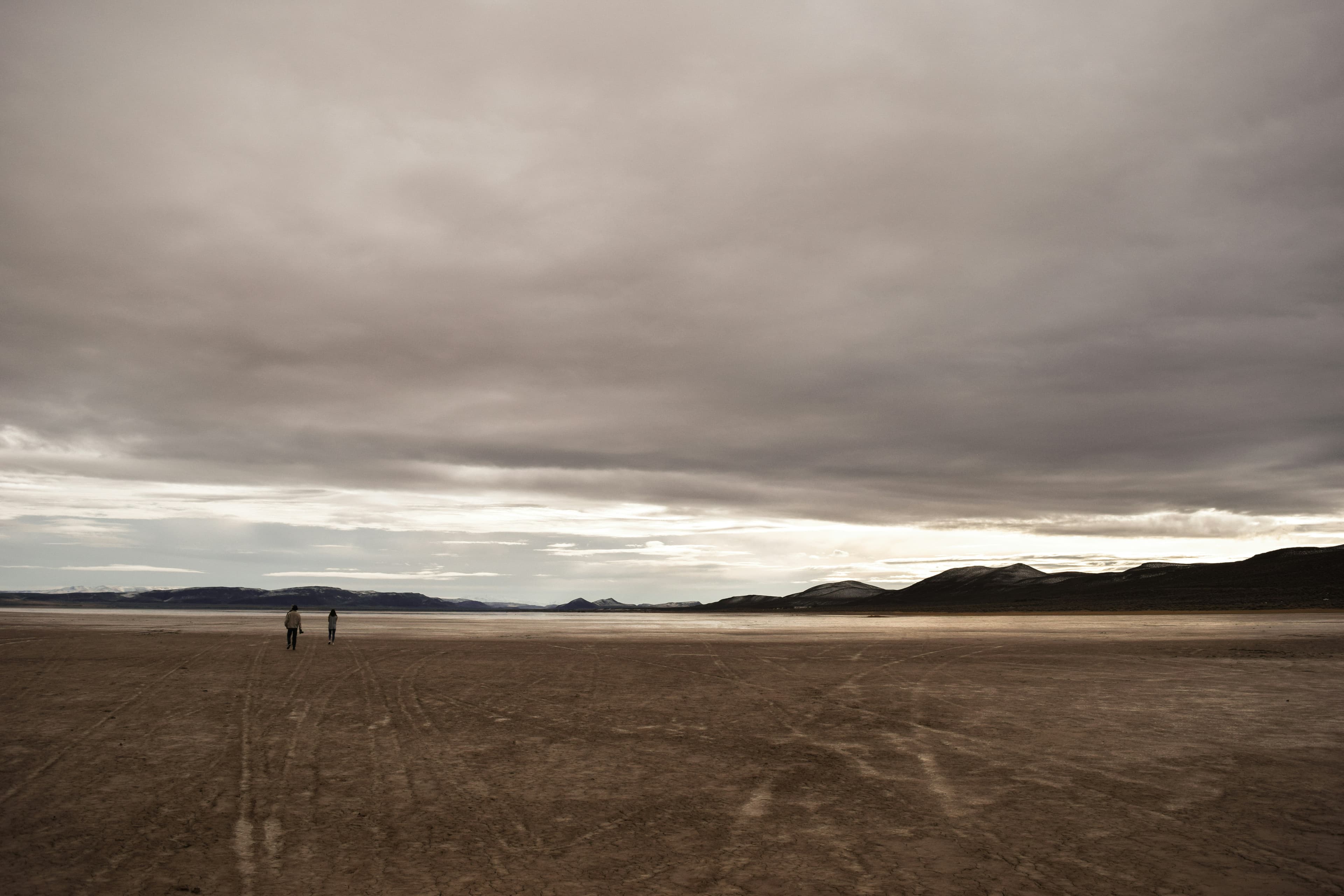
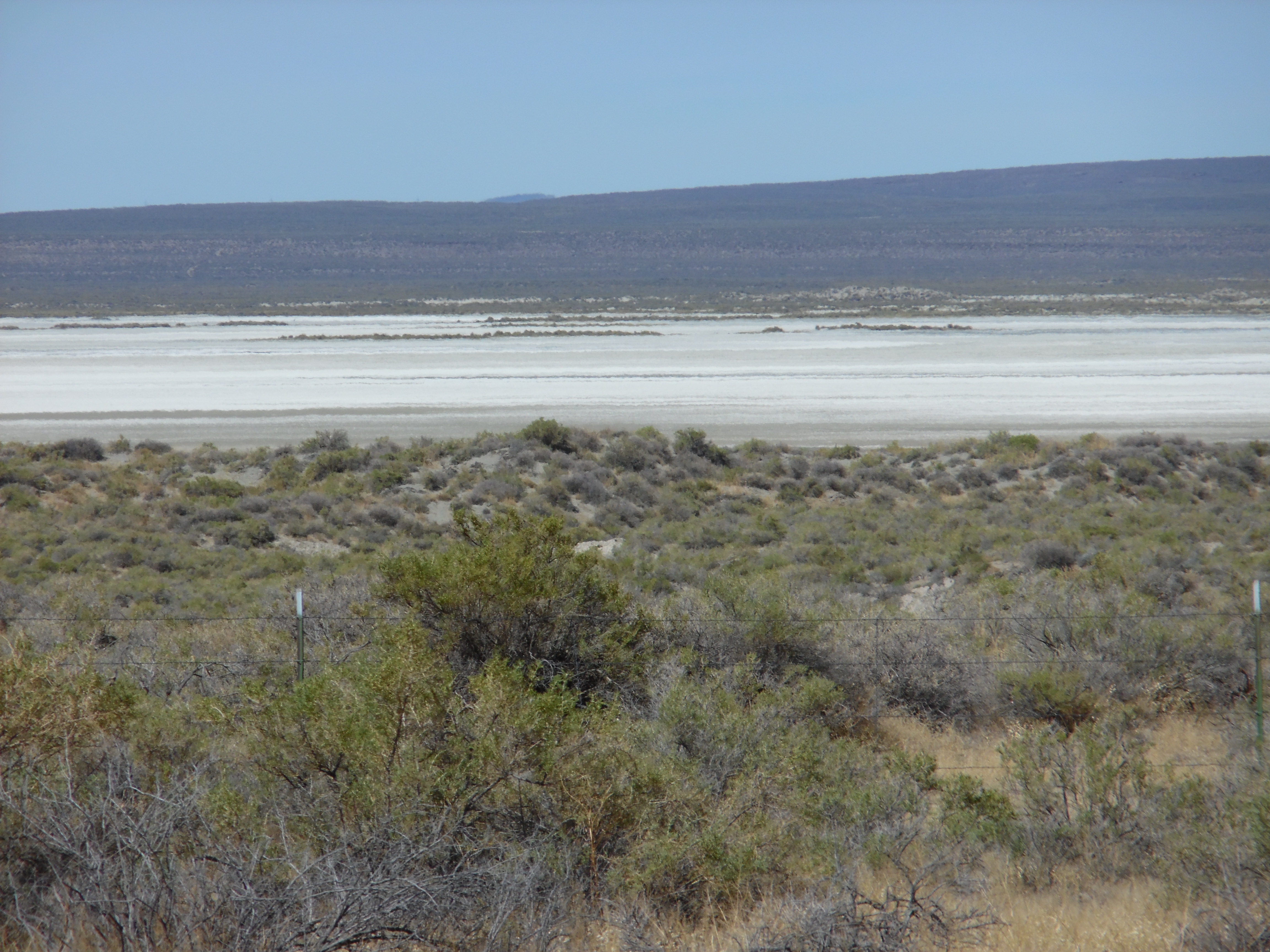
Alkali Lake is a broad, usually dry basin. A state geological study describes an eight-mile-long lake bed and the old shoreline of a much larger lake. It records salt extraction here in the 1920s. Those are facts about the basin, not mineral rights or a business opportunity on these acres. The draw is simpler: enough land to watch the basin change from its northern edge, and room to walk from the sagebrush down toward the flats.
The nearby spring names on a map do not establish a water supply on this parcel. Surface conditions vary, and no well, utility service or legal access route is being represented here. Please arrange a visit with Peter before setting out.
Property taxes and county records
Lake County account 8986
- Acreage
- 290.88 acres
- County parcel reference
- 30S23E00-00-00302
- Discounted annual tax
- $584.49
- Record last updated
- 2025
Buyer due diligence
Before you buy
These listings and maps do not grant permission to enter any property or cross neighboring land. Visits to land offered for sale must be arranged with Peter in advance and use an authorized route. A sold listing is not an invitation to visit its current owner's land.
Buyers must independently verify recorded legal access and easements, road conditions and maintenance, water availability and water rights, well feasibility, power and other utilities, septic suitability, boundaries, title restrictions, and mineral rights.
Confirm zoning, permits, and whether your intended use is allowed with the county and relevant agencies, including building a home, camping, RV use, or renting to guests. Check flood and wetland restrictions and the cost of any improvements. A visible road, nearby power line, or mapped water does not establish a right to use it. Listing descriptions and maps are for general information and do not guarantee access, services, boundaries, or permission to build. Consult the county, utility providers, a title company, and qualified professionals before committing to a purchase.