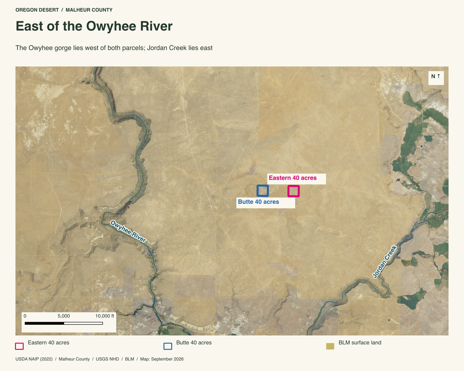
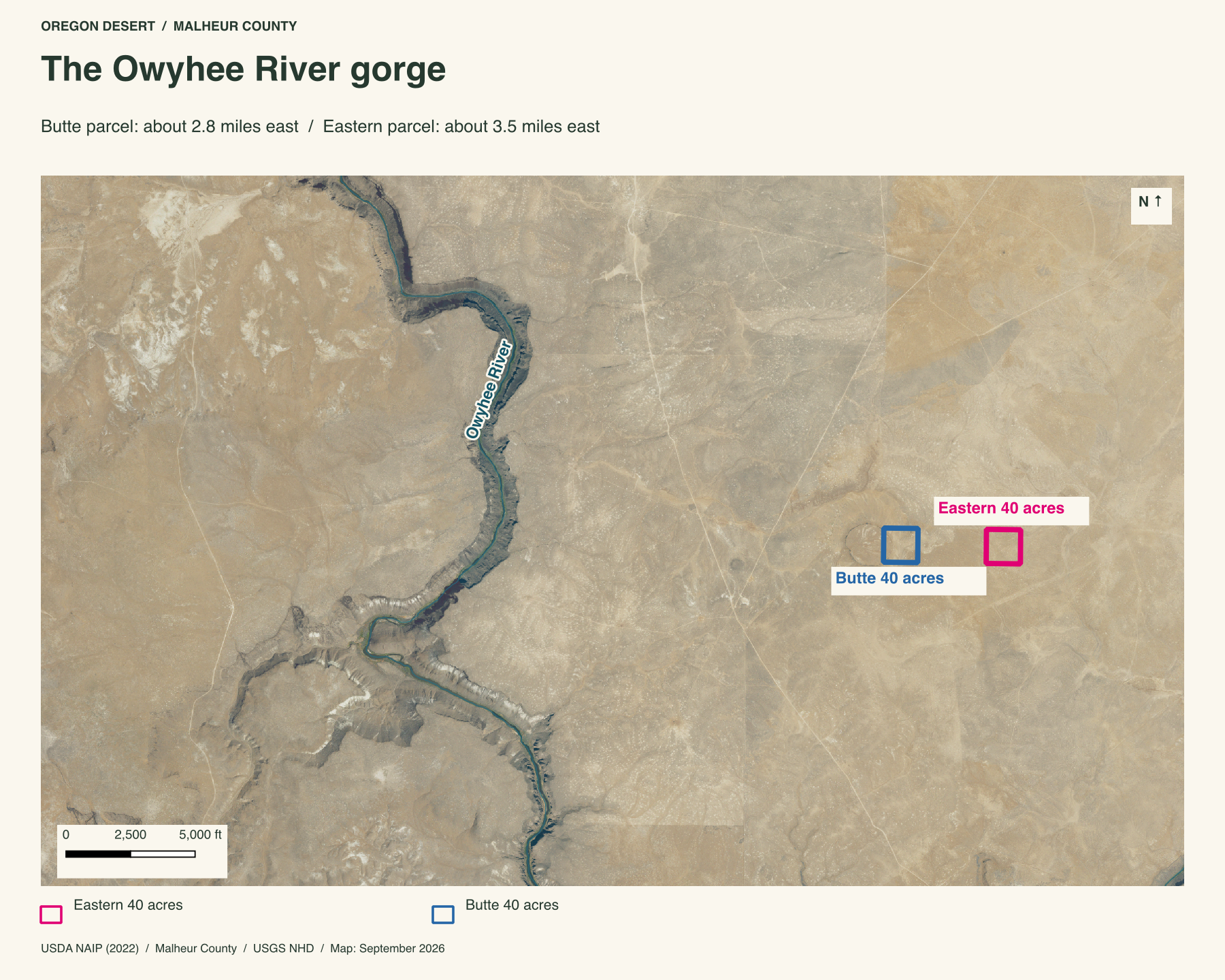
Forty acres about 3.5 miles east of the Owyhee River and its winding gorge. This is open Malheur County plateau: sagebrush, pale volcanic ground and Little Owyhee Butte rising nearby to the west. Jordan Creek is a separate drainage to the east.
Two parcels, one piece of Owyhee country
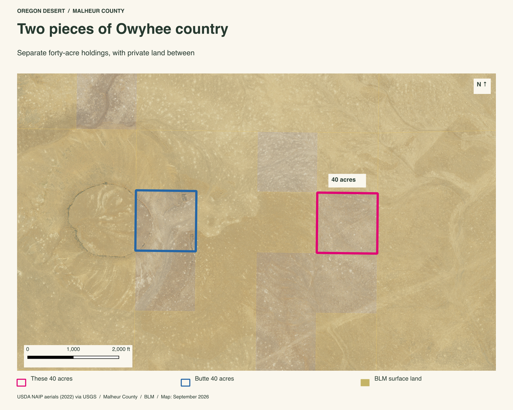
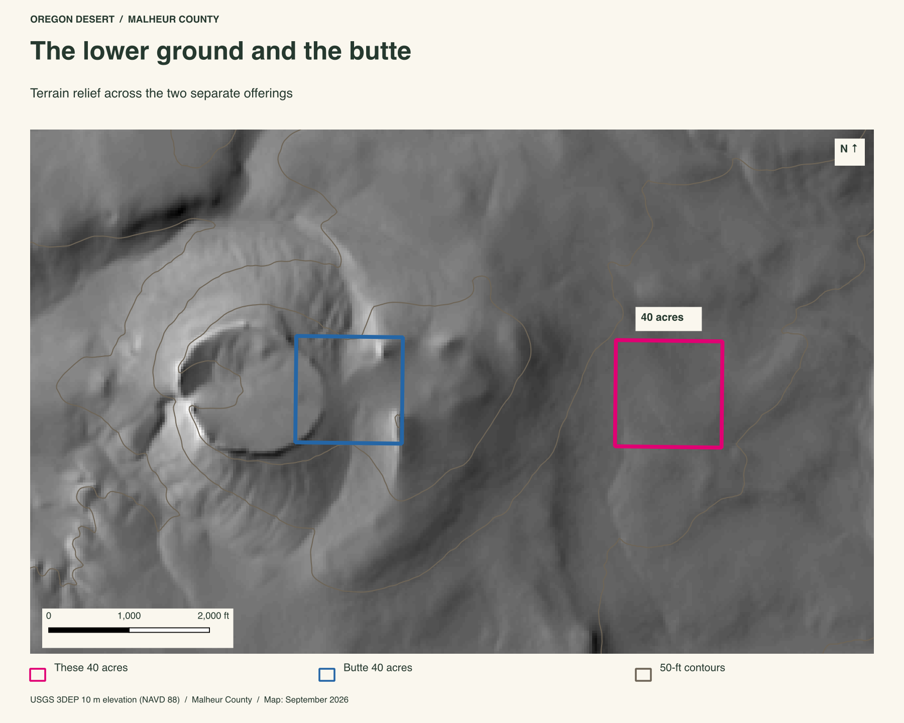
We also offer forty acres on Little Owyhee Butte. The two mapped boundaries are about half a mile apart in a straight line. They are separate holdings, with another private parcel between them, and can be bought together. The distance is not a driving or walking route.
The Owyhee gorge to the west
The river makes a deep cut through the plateau. In the aerial view, bare canyon walls follow bend after bend, with a narrow green strip beside the water. These forty acres lie on the open ground east of that broken country. The 3.5-mile distance is a straight-line estimate to the mapped river channel.
Open ground below the rise
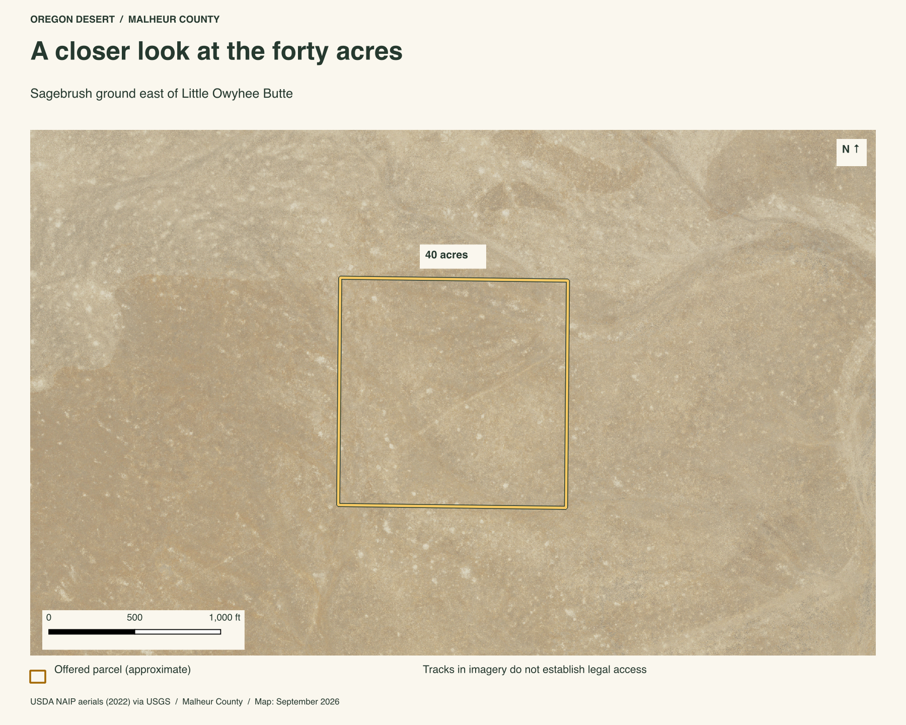
The appeal here is room and distance. The land is lower and gentler than the butte parcel, with no rimrock crest inside its outline. The aerial map shows light soil, scattered vegetation and faint surface tracks. Those marks on an image do not establish a legal access route.
Owning this ground
The county reports forty acres. Its mapped sides run about 1,330 feet north and south and about 1,320 feet east and west. This is land for someone who wants a quiet piece of the Oregon desert, or wants to pair open ground with the nearby rise of Little Owyhee Butte. No well, utilities or legal access route is represented here. Arrange a visit with Peter before setting out.
Property taxes and county records
Malheur County account 11761
- Acreage
- 40 acres
- County parcel reference
- 30S41 700
- Discounted annual tax
- $24.83
- Record last updated
- 2025
Buyer due diligence
Before you buy
These listings and maps do not grant permission to enter any property or cross neighboring land. Visits to land offered for sale must be arranged with Peter in advance and use an authorized route. A sold listing is not an invitation to visit its current owner's land.
Buyers must independently verify recorded legal access and easements, road conditions and maintenance, water availability and water rights, well feasibility, power and other utilities, septic suitability, boundaries, title restrictions, and mineral rights.
Confirm zoning, permits, and whether your intended use is allowed with the county and relevant agencies, including building a home, camping, RV use, or renting to guests. Check flood and wetland restrictions and the cost of any improvements. A visible road, nearby power line, or mapped water does not establish a right to use it. Listing descriptions and maps are for general information and do not guarantee access, services, boundaries, or permission to build. Consult the county, utility providers, a title company, and qualified professionals before committing to a purchase.