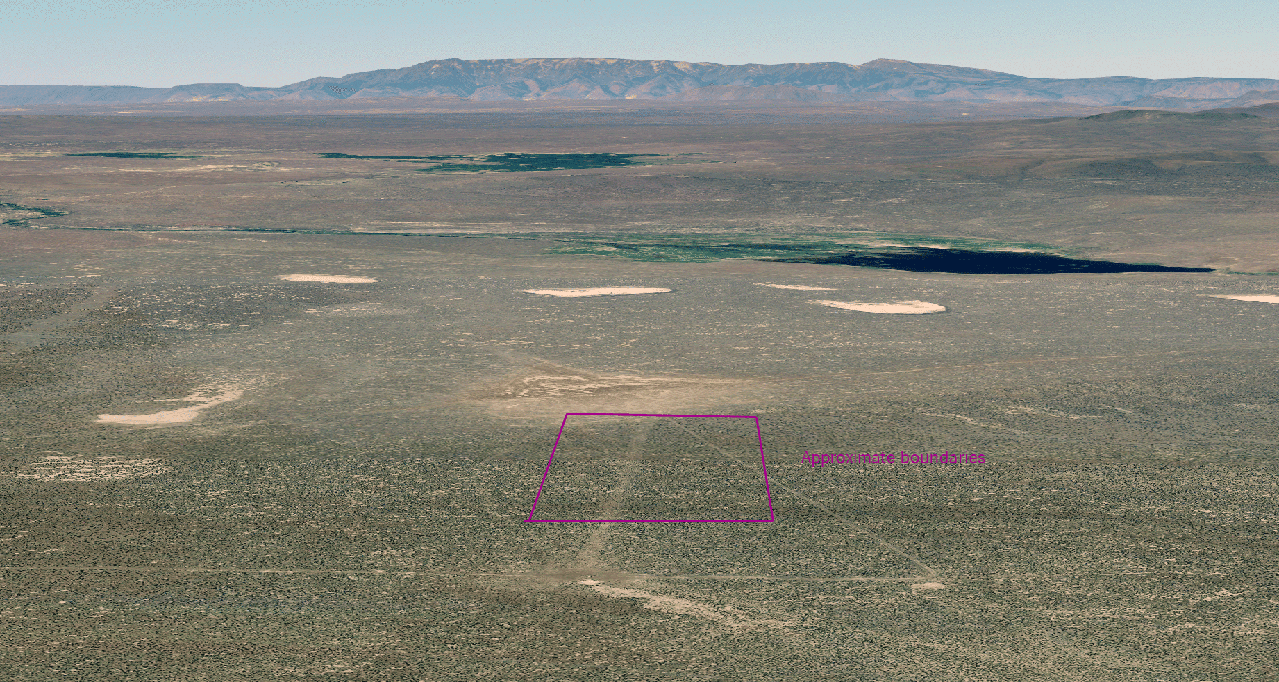
Old lava ground breaks into shallow draws across these forty acres in Malheur County. The aerial view shows the pattern clearly: an open plateau cut by drainage lines, with low ridges between them. Steens Mountain lies across the country to the west.

An aerial view looking west across the parcel toward Steens Mountain.
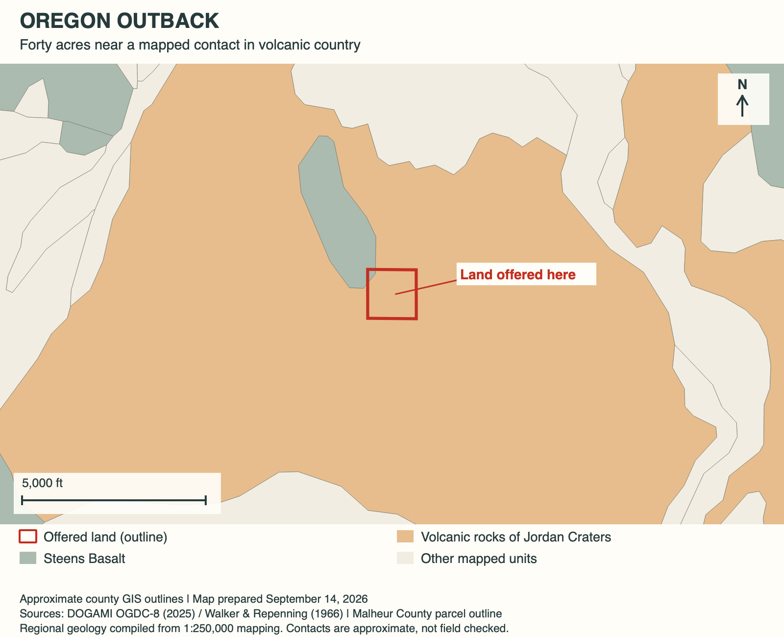
Two mapped volcanic units meet nearby
The interest is underfoot as much as on the horizon. Regional mapping places the parcel beside a contact between volcanic units, with Steens Basalt reaching its northwest corner. These are broad map boundaries, but they give a curious owner something specific to follow in the shape and texture of the ground.
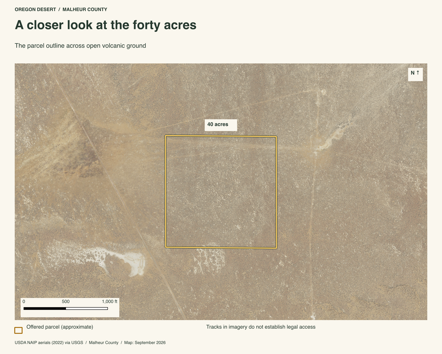
Draws across the forty acres
The closer aerial view brings those broad geologic colors back to the ground. Shallow drainage lines break up the parcel, with tracks visible between them. They give the forty acres more texture than its square outline suggests.
Sagebrush on the lava plateau
Sagebrush and grasses occupy this dissected lava plateau. The ecoregion map identifies big sagebrush and bottlebrush squirreltail as characteristic vegetation of this country.

The purple box marks the 40 acres. The mapped ecoregion is "dissected high lava plateau," with big sagebrush and bottlebrush squirreltail among the main vegetation.
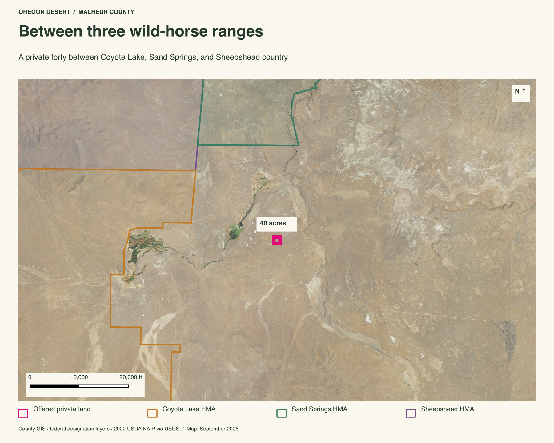
Between three wild-horse ranges
Three BLM wild-horse ranges come together around this forty. The Coyote Lake-Alvord-Tule Springs range begins about 3.2 miles west, the Sand Springs range about 3.6 miles east, and the Sheepshead-Heath Creek range about 3.9 miles south. The private square sits between nearly a million mapped acres of horse country.
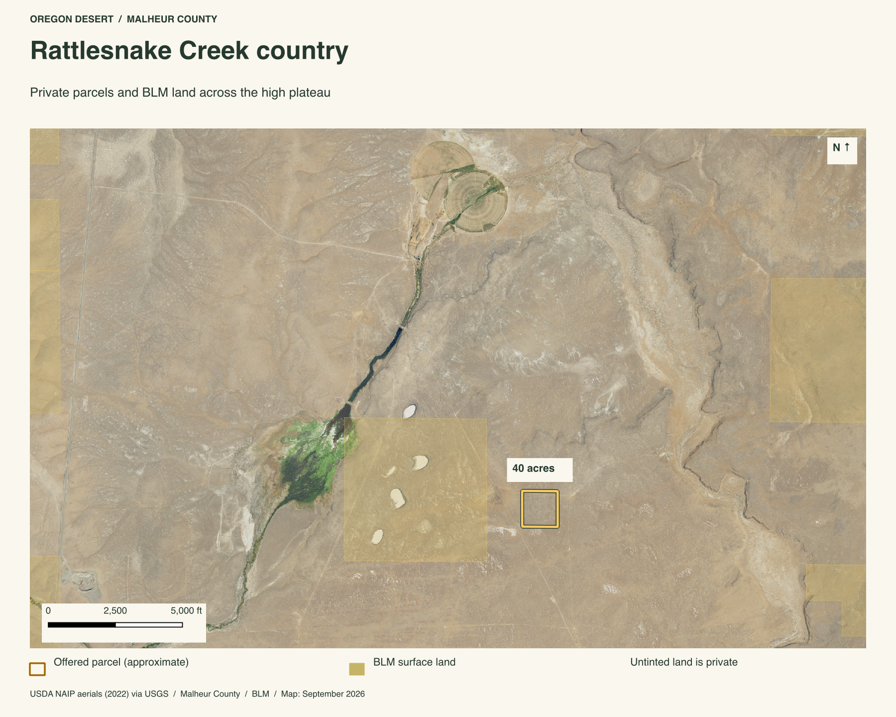
Maps of the Rattlesnake Creek country
Farther out, the draws continue through a mix of public and private ground. Gold shading marks BLM surface land in the map below. The forty acres sit within that larger pattern, with Steens Mountain across the country to the west.
There is no power at the property. U.S. 95 is about five miles away, with unpaved roads in between. For someone drawn to volcanic country, this is a small holding with slopes, rock, and a long western view to get to know.
What's the legal description?
33S 40E WM section 15 tax lot 3700.
Is there power to the property?
No. This is off-grid land.
What should a buyer know about the approach?
Unpaved roads connect this country with U.S. 95. Wet weather can make them muddy. Contact Peter to discuss the property and an arranged visit.
What's the elevation?
3,860 feet above sea level.
How big is 40 acres?
A square forty-acre parcel is roughly a quarter mile on each side. See the county outline for the shape of this holding.
Property taxes and county records
Malheur County account 12370
- Acreage
- 40 acres
- County parcel reference
- 33S40 3700
- Discounted annual tax
- $59.34
- Record last updated
- 2025
Buyer due diligence
Before you buy
These listings and maps do not grant permission to enter any property or cross neighboring land. Visits to land offered for sale must be arranged with Peter in advance and use an authorized route. A sold listing is not an invitation to visit its current owner's land.
Buyers must independently verify recorded legal access and easements, road conditions and maintenance, water availability and water rights, well feasibility, power and other utilities, septic suitability, boundaries, title restrictions, and mineral rights.
Confirm zoning, permits, and whether your intended use is allowed with the county and relevant agencies, including building a home, camping, RV use, or renting to guests. Check flood and wetland restrictions and the cost of any improvements. A visible road, nearby power line, or mapped water does not establish a right to use it. Listing descriptions and maps are for general information and do not guarantee access, services, boundaries, or permission to build. Consult the county, utility providers, a title company, and qualified professionals before committing to a purchase.