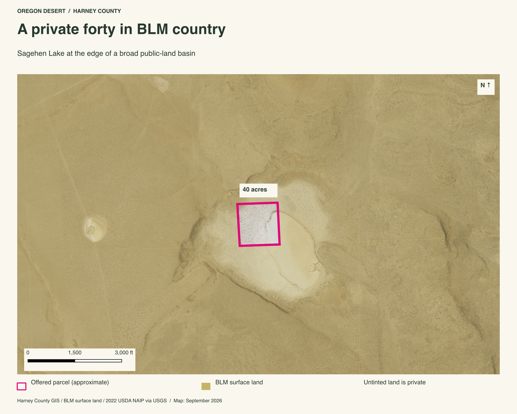
A private forty at Sagehen Lake, with BLM land on every side. The parcel takes in the northwest side of a seasonal basin. This is a rare place to own a piece of the lake bed and return to watch it change, while the surrounding sagebrush and low ridges remain public ground.
An inholding at Sagehen Lake
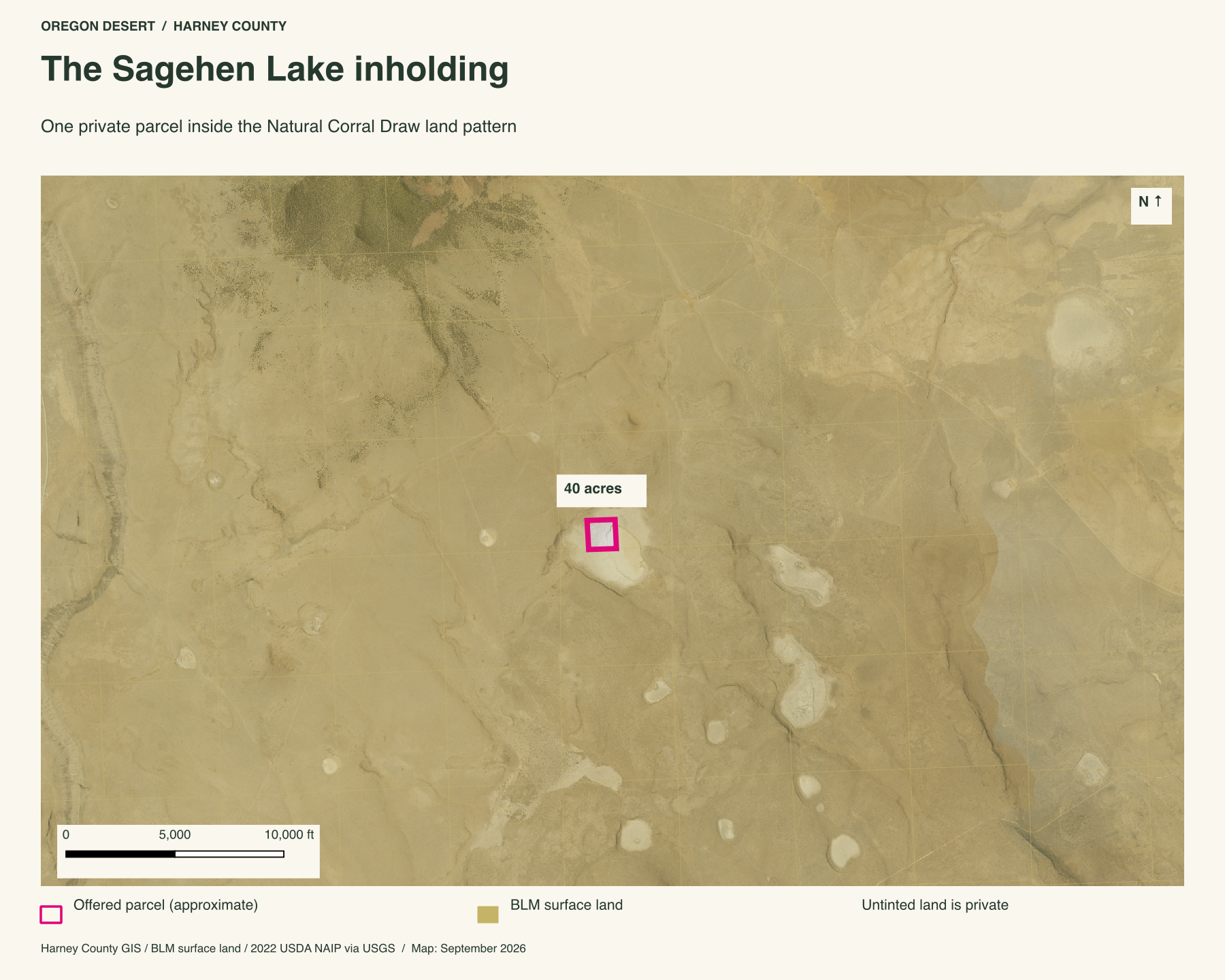
BLM's Natural Corral Draw inventory identifies a 40-acre private inholding at Sagehen Lake in a roughly 14,156-acre unit of BLM-managed land. The current surface-land map likewise shows BLM ground meeting all four sides of the county parcel. For someone who likes to wander, the scale is the point: your own place at the lake, with a broad public landscape of basins, sagebrush and low hills around it.
The wild country ONDA mapped around Sagehen
In 2005, Oregon Natural Desert Association mapped 67,948 acres here as the proposed Juniper Mountain Wilderness Study Area. Its field inventory treated Sagehen Lake, Natural Corral Draw, the neighboring lake beds and Juniper Mountain as one large wild landscape. ONDA supplied route logs, photographs, maps and GIS data. The BLM Natural Corral Draw report preserves that proposal and names Sagehen's forty-acre private inholding.
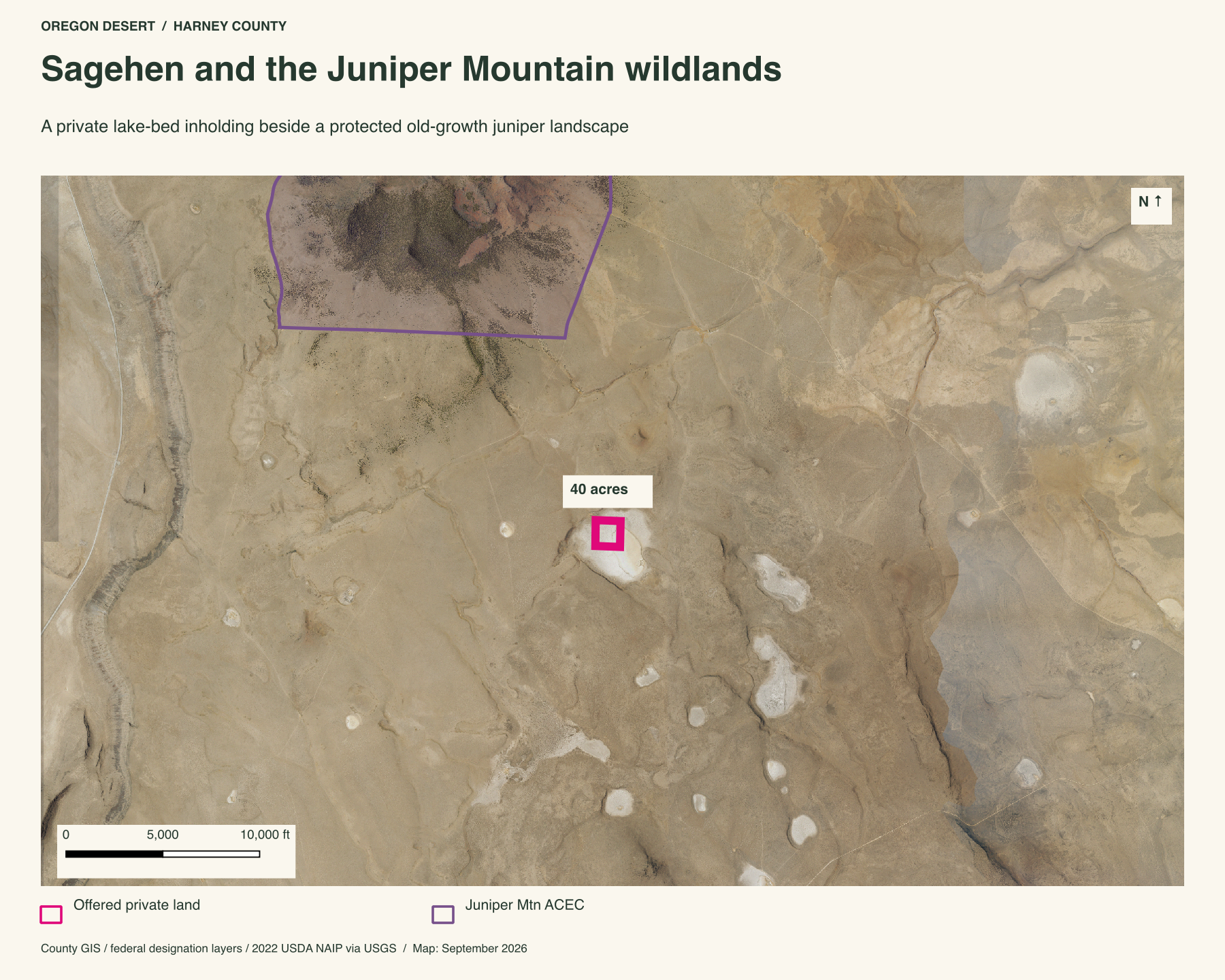
That proposal was larger than the federal designations mapped today. The current BLM overlay puts the Juniper Mountain Area of Critical Environmental Concern about 1.8 miles east of the parcel. The larger point survives either line: conservation groups and federal land managers have studied this basin as wild country, and this forty is a small private foothold within it.
Explore the maps and records
The BLM's Natural Corral Draw account names the 40-acre inholding at Sagehen Lake and records ONDA's proposed Juniper Mountain wilderness-study boundary. Its final-page map shows the inventory unit, public and private land, and mapped routes. For ONDA's own account of the fieldwork and the resulting BLM review, read its Winter 2006 Desert Ramblings report. Compare those records with the BLM Oregon surface-land layer used for the gold shading in the maps above.
To follow the lake's changing outline, use the National Wetlands Inventory mapper and the Global Surface Water Explorer. The 1984-2024 satellite water data behind the map below are available for a closer look.
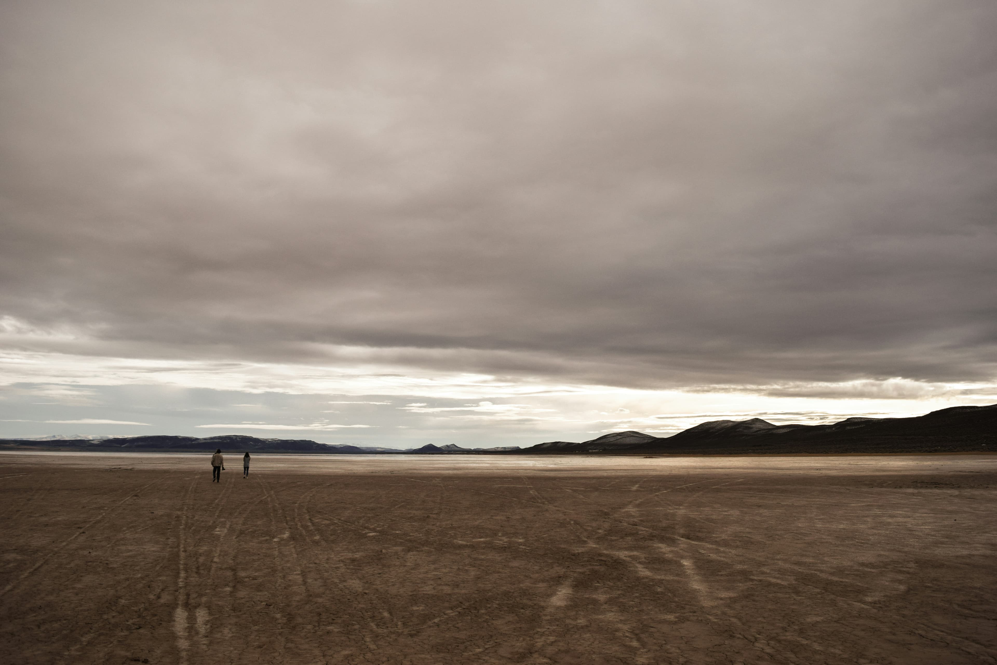
BLM describes a series of shallow lake-bed depressions across Natural Corral Draw. Sagehen is the largest named in its older inventory account. The photographs below show the dry side of that pattern in fall, when the exposed ground records what has passed across it.
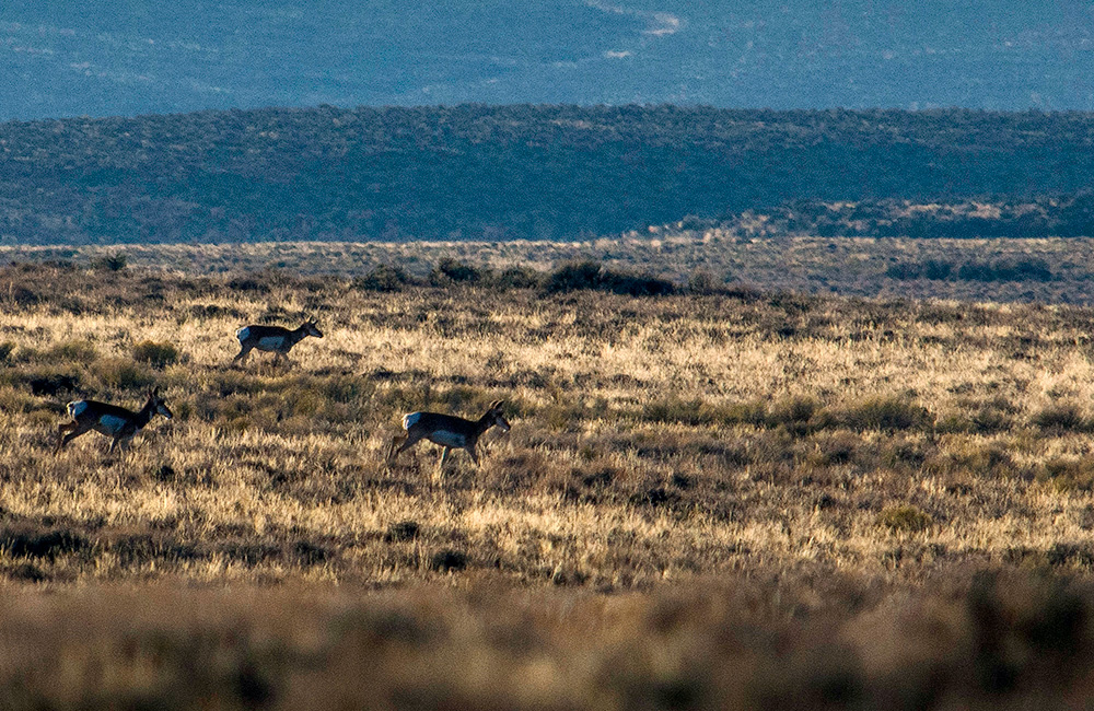
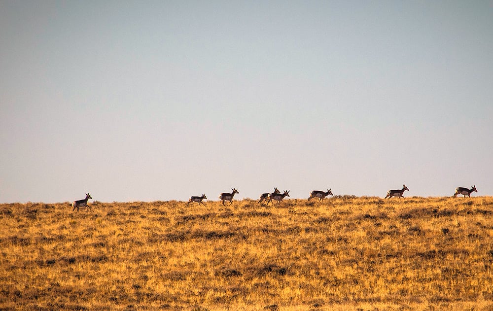
Pronghorn in the distance, photographed from the property.
The animals leave a closer record in the pale soil. Hoofprints cut through the crust between clumps of grass, continuing after the pronghorn have moved out of sight. These fall photographs show that dry side of Sagehen.

Deer and pronghorn tracks on the lake bed. Water is scarce in the surrounding country.
Where water returns
Sagehen is seasonal. Water can gather in the basin and retreat, leaving the lake rim and its grasses above a pale, open floor. Owning a piece of this place means getting to know those changes. A wet spring and a dry autumn can leave very different impressions of the same ground.
The water-history map puts those dry photographs in context. Most of the stronger water detections lie farther south in the basin. The forty acres occupy its northwest side.
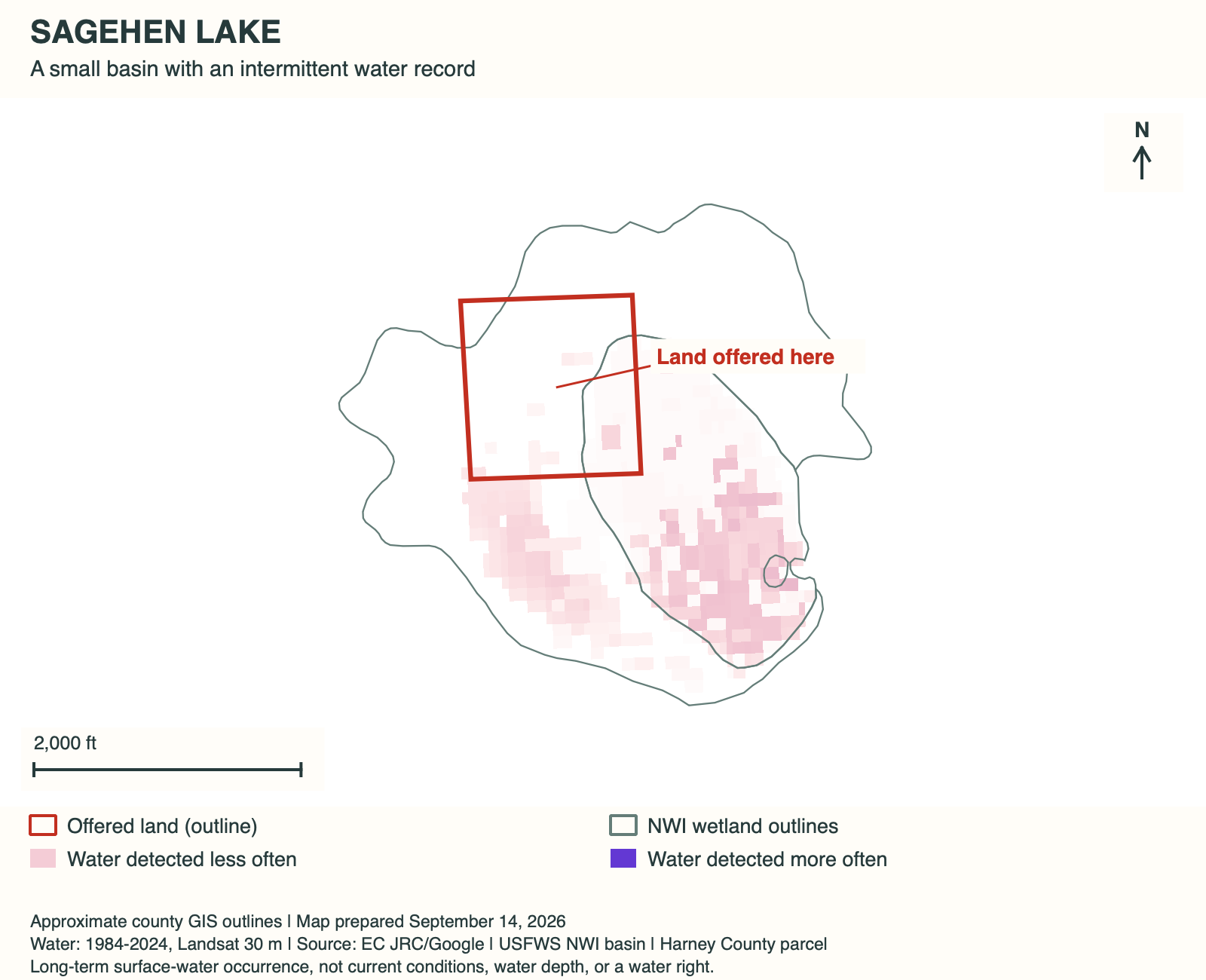
The forty acres take in the basin's northwest side. The plat below labels Sagehen "dry," a reminder of how much the water changes this place.

The plat labels the lake "dry." Water varies with the season and can be low in midsummer. This is the only private parcel shown on the plat.
Juniper Mountain beyond the basin
Nearby Juniper Mountain rises about 1,300 feet above the sagebrush flats. Its rim bends into a horseshoe, with ridges and saddles around the curve. Higher ground supports western juniper woodland, a marked change from the low, open basin at Sagehen.

Looking north toward Juniper Mountain. The trees on the mountain give wildlife cover.
BLM's 2020 Juniper Mountain inventory describes old-growth woodland protected on Juniper Mountain within an Area of Critical Environmental Concern and Research Natural Area.

Looking north across the basin toward the surrounding sagebrush hills.
Around the lake rim
The mountain's wooded slopes give way to much more open ground at the lake. These two views across the basin show the low rim and the country beyond it. The grasses and distant ridges give a sense of how exposed the forty acres are.

Across the lake bed toward Winter Rim, looking west, I think.

Hart Mountain in the distance. I believe this view looks southeast across the property.
Between Lakeview and Burns
The parcel lies in Harney County, northeast of Lake Abert and Abert Rim. Lakeview is to the south and Burns to the north. This is open plateau country between towns, with no power at the property.

Sagehen Lake lies north of Lakeview, southeast of Bend, and south of Burns, in the country near Hart Mountain National Antelope Refuge.
The roads narrow that broad regional view to the last stretch of country around Juniper Mountain. The photograph below shows the approach in dry weather. Rain can change it quickly.

The road around Juniper Mountain on the way to Sagehen Lake.
What's the legal description?
31S 24E WM section 16 tax lot 200.
Is there power to the property?
No. There is no power at the property.
What should a buyer know about the approach?
The approach includes a rough dirt road labeled Eagle Butte Road on some maps. Wet weather can leave it muddy. Ask Peter about current conditions when arranging a visit.
What's the elevation?
5,200 feet above sea level.
Is there wildlife in the area?
I've seen pronghorn and plenty of raptors in the area. The photographs above show pronghorn and tracks around the lake bed.
How big is 40 acres?
A square forty-acre parcel is roughly a quarter mile on each side. The county map above shows the shape of this one.
Property taxes and county records
Harney County account 20000
- Acreage
- 40 acres
- County parcel reference
- 31S24E000000200
- Discounted annual tax
- $34.11
- Record last updated
- 2025
Buyer due diligence
Before you buy
These listings and maps do not grant permission to enter any property or cross neighboring land. Visits to land offered for sale must be arranged with Peter in advance and use an authorized route. A sold listing is not an invitation to visit its current owner's land.
Buyers must independently verify recorded legal access and easements, road conditions and maintenance, water availability and water rights, well feasibility, power and other utilities, septic suitability, boundaries, title restrictions, and mineral rights.
Confirm zoning, permits, and whether your intended use is allowed with the county and relevant agencies, including building a home, camping, RV use, or renting to guests. Check flood and wetland restrictions and the cost of any improvements. A visible road, nearby power line, or mapped water does not establish a right to use it. Listing descriptions and maps are for general information and do not guarantee access, services, boundaries, or permission to build. Consult the county, utility providers, a title company, and qualified professionals before committing to a purchase.