Refuge country, close at hand
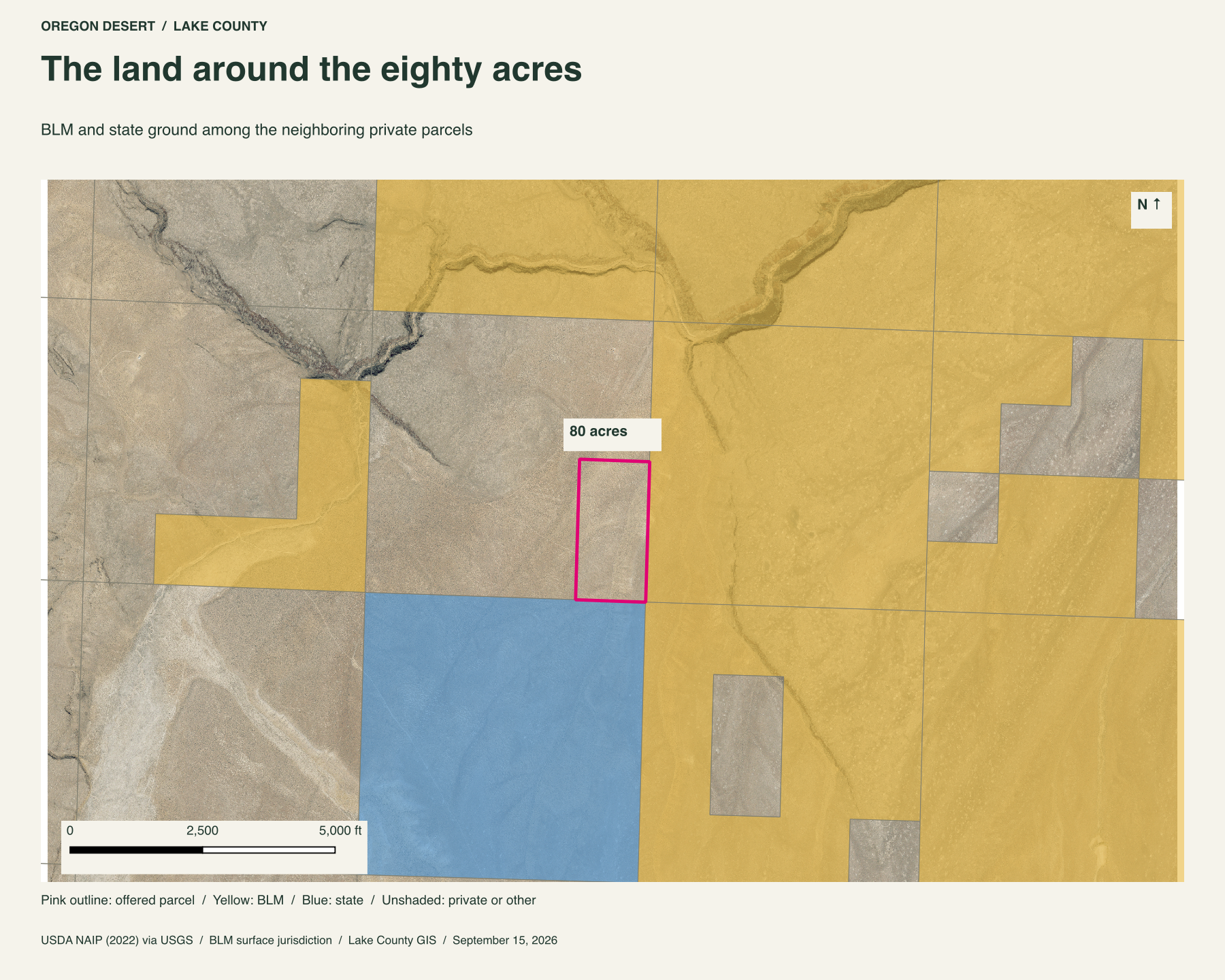
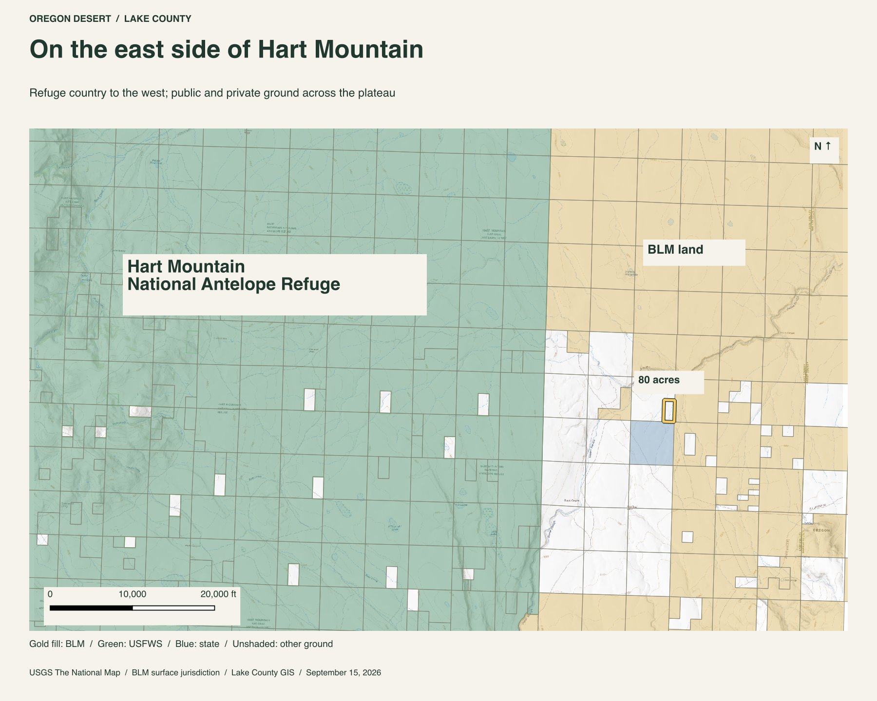
BLM ground lies along the eastern side and state ground to the south. Private parcels lie north and west. Beyond them, Hart Mountain National Antelope Refuge spreads across the mountain.
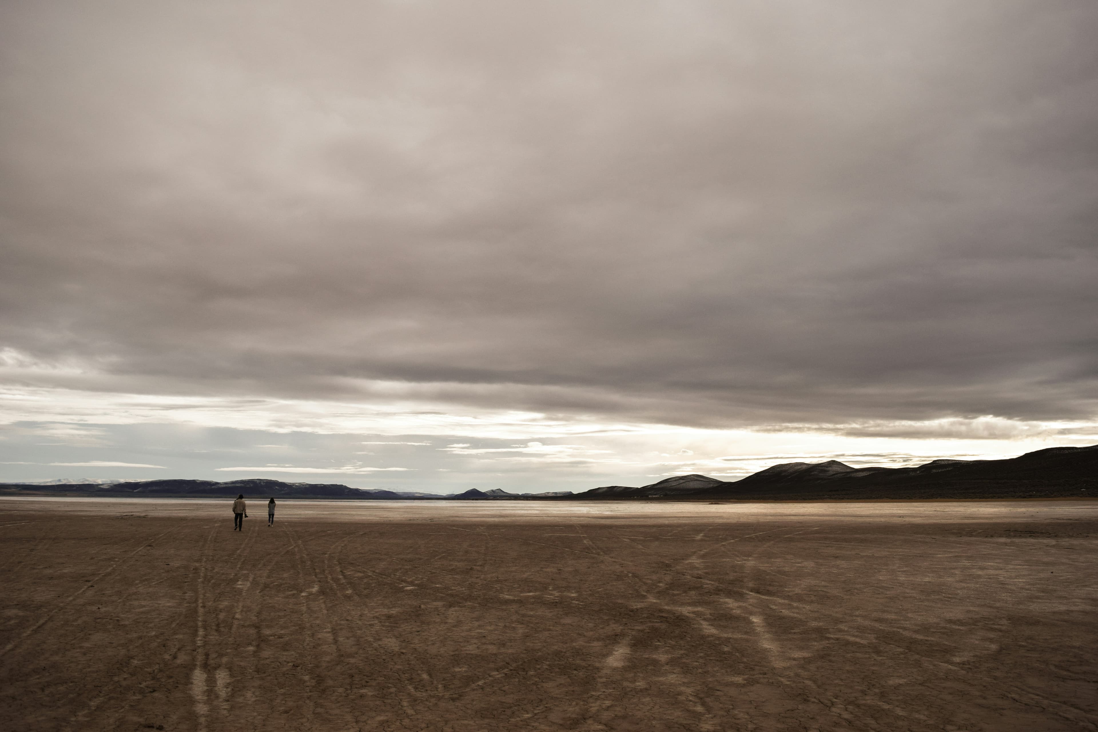
I drove all day to reach this property and never saw another car. The roads were rough, and the country was a sea of sagebrush.
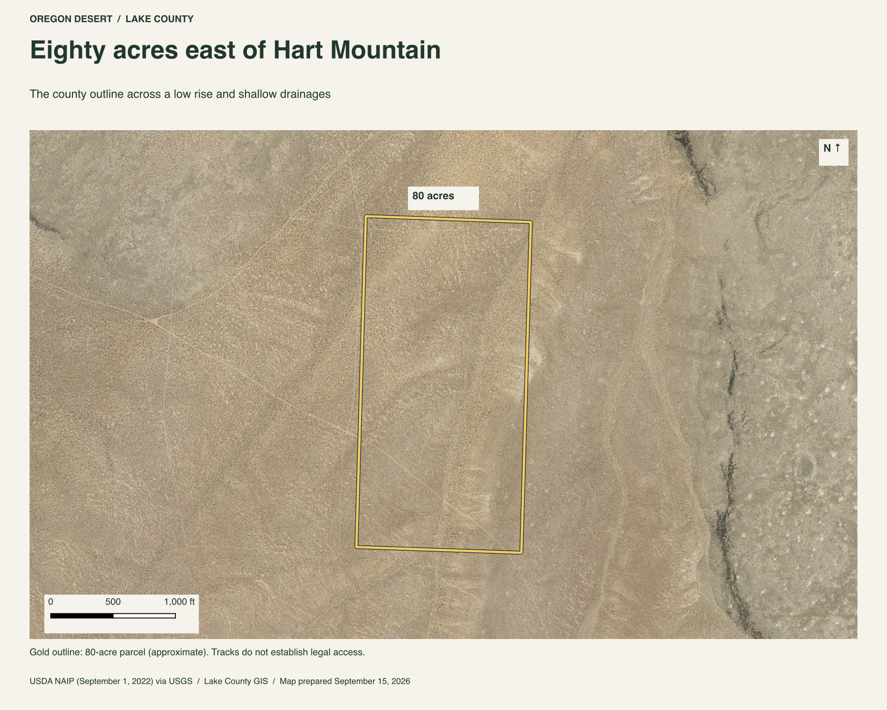
These eighty acres lie just east of Hart Mountain National Antelope Refuge, about three miles from its nearest boundary in a straight line. Beatys Butte rises to the southeast. Between them is this stretch of Lake County high desert, with low ridges and shallow draws running through the sagebrush.
Out here, you can own a quarter-mile-wide strip of ground that runs half a mile north to south. The aerial follows that long outline across the rise and its two seasonal drainages.
The shape of the ground
A low shoulder occupies much of the parcel, with a shallow drainage crossing its eastern side and another clipping the northwest. Across the eighty acres, the ground rises and falls about sixty feet, from roughly 4,850 to 4,910 feet above sea level. There is room to follow a draw, climb the rise, and choose a different way back.
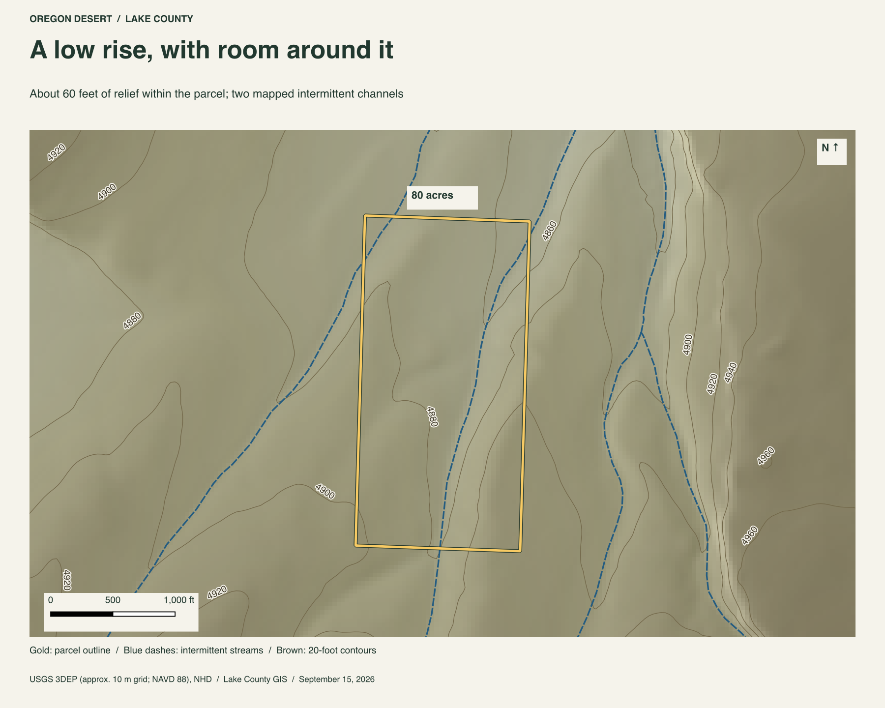
USGS maps both channels as intermittent streams. They are seasonal draws. Bring your own water.
Pronghorn country
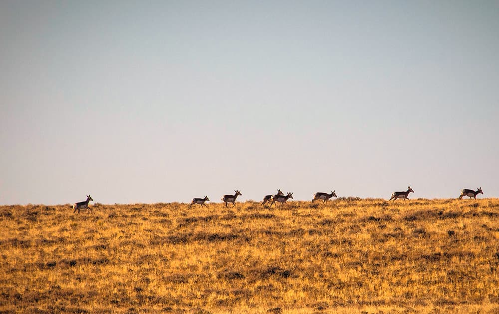
Hart Mountain was set aside in 1936 to protect pronghorn and other wildlife. Pronghorn are North America's fastest land mammal, built for the open country. The refuge's eastern sagebrush grasslands are one of the places visitors may see them, along with greater sage-grouse. Mule deer and bighorn sheep also live on the refuge.
Hart Mountain's steep western face stands above Warner Valley. On this eastern side, the mountain descends through rolling hills and low ridges into the sagebrush. The property sits beyond the refuge boundary, close to that protected country.
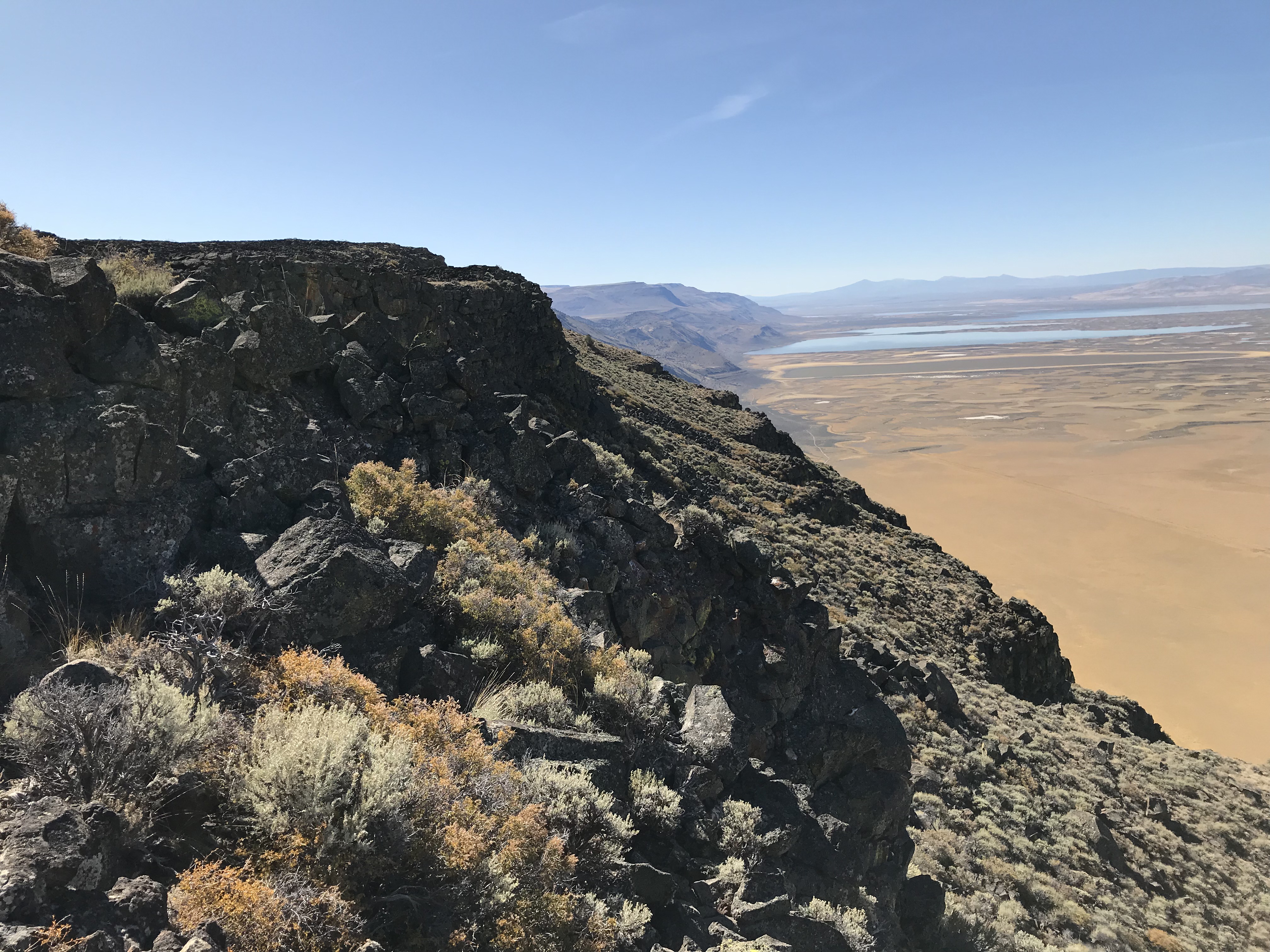
The refuge's visitor guide covers wildlife watching, walking and photography, with current information for planning a day there.
Beatys Butte rises about seven miles southeast of the property in a straight line, measured to its mapped summit. Hart Mountain and Beatys Butte put these eighty acres between two landmarks in a long stretch of sagebrush country.
The road is rough, and recorded access has not been confirmed. Get in touch before planning a visit.
Property taxes and county records
Lake County account 10041
- Acreage
- 80 acres
- County parcel reference
- 36S28E00-00-01200
- Discounted annual tax
- $193.22
- Record last updated
- 2025
Buyer due diligence
Before you buy
These listings and maps do not grant permission to enter any property or cross neighboring land. Visits to land offered for sale must be arranged with Peter in advance and use an authorized route. A sold listing is not an invitation to visit its current owner's land.
Buyers must independently verify recorded legal access and easements, road conditions and maintenance, water availability and water rights, well feasibility, power and other utilities, septic suitability, boundaries, title restrictions, and mineral rights.
Confirm zoning, permits, and whether your intended use is allowed with the county and relevant agencies, including building a home, camping, RV use, or renting to guests. Check flood and wetland restrictions and the cost of any improvements. A visible road, nearby power line, or mapped water does not establish a right to use it. Listing descriptions and maps are for general information and do not guarantee access, services, boundaries, or permission to build. Consult the county, utility providers, a title company, and qualified professionals before committing to a purchase.