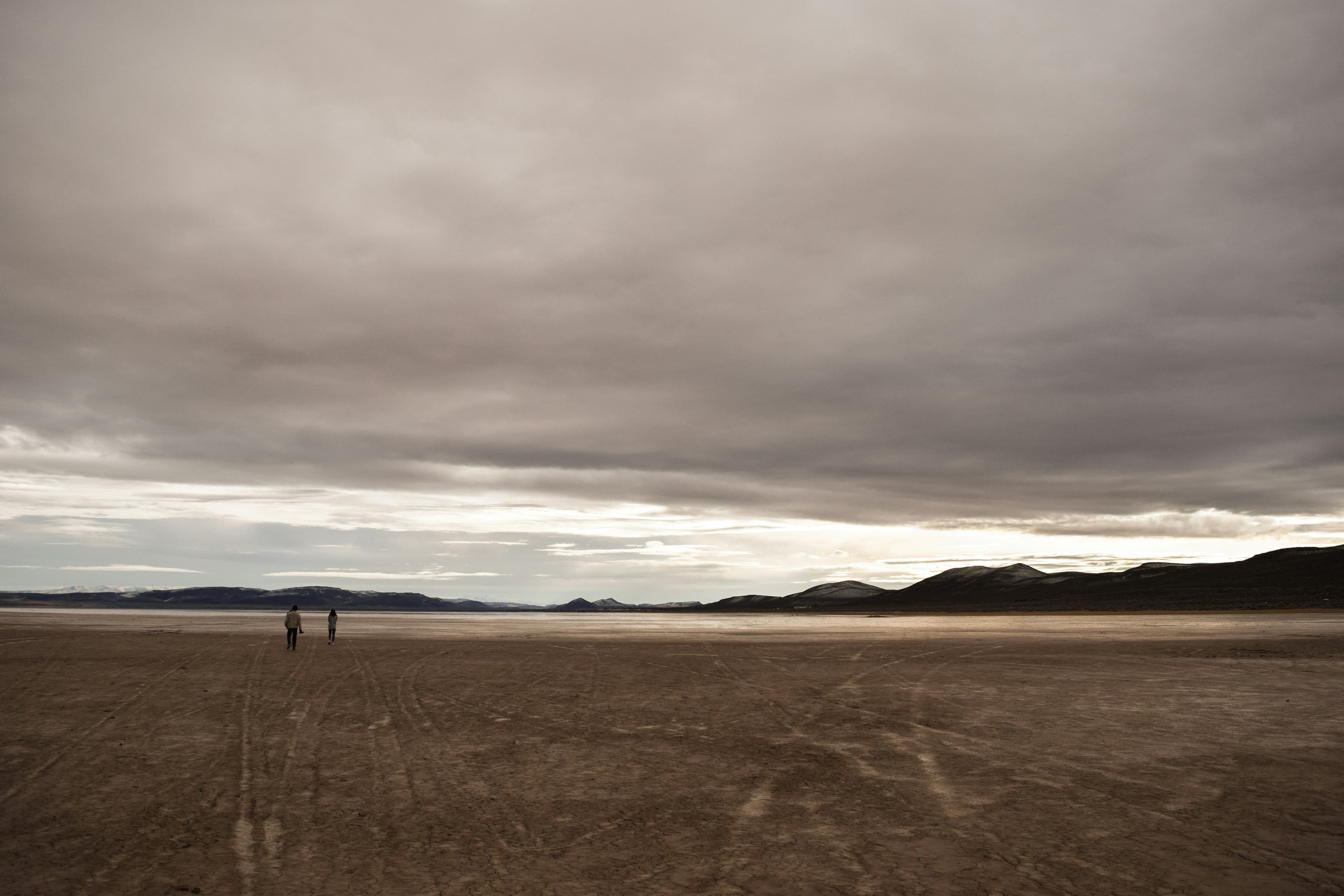
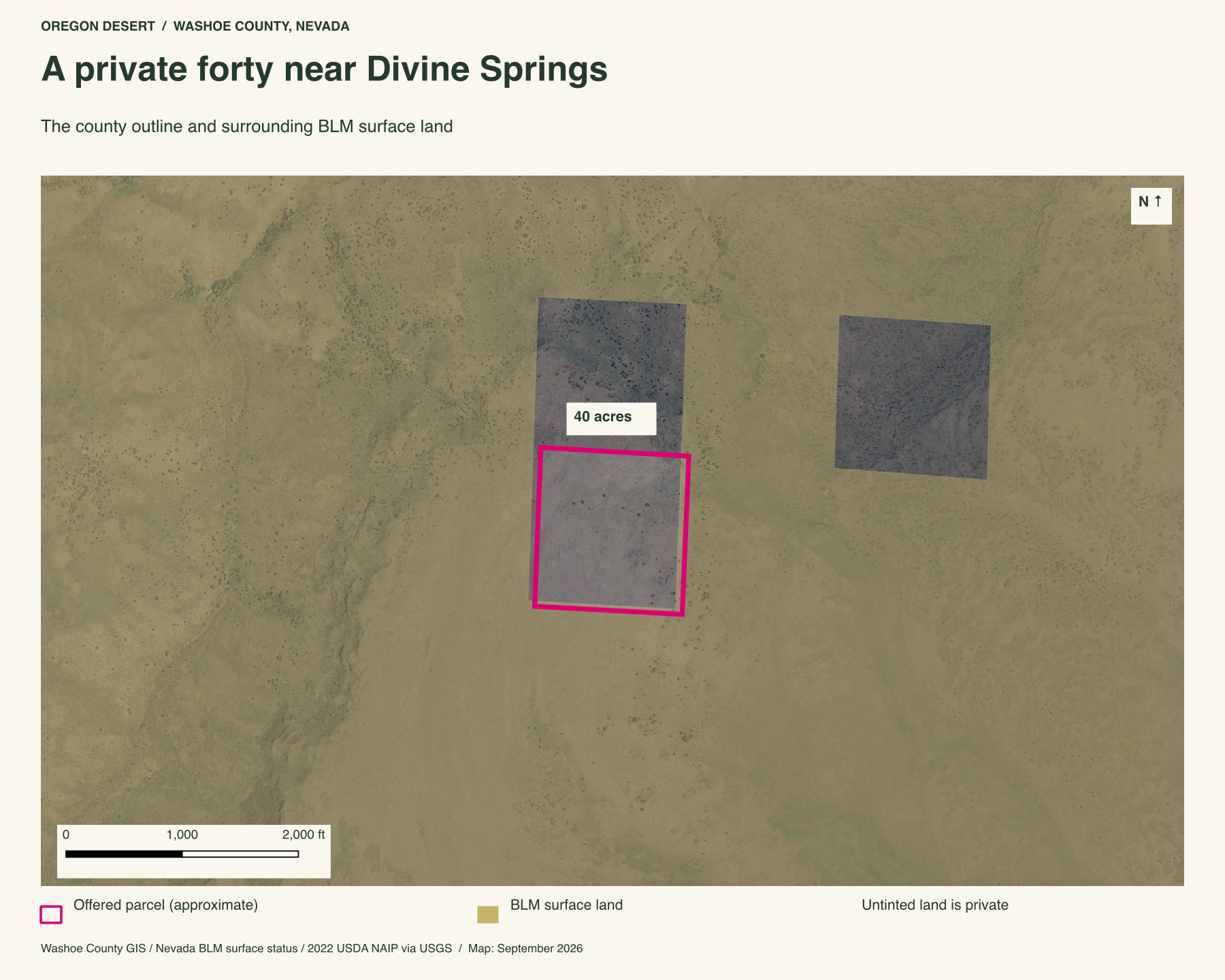
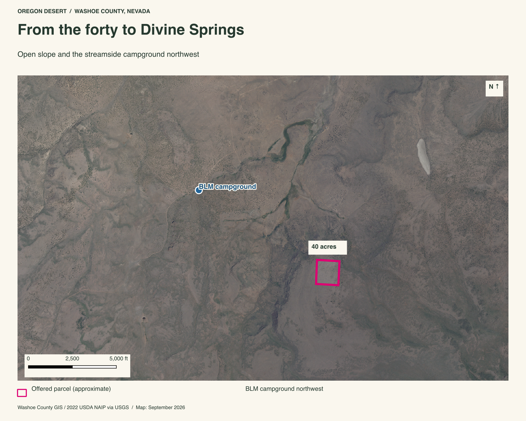
Forty private acres in a wide reach of BLM country near Divine Springs, in northern Washoe County, Nevada. The parcel climbs an open slope below a broken rim. Gold on the maps wraps around most of it. A small BLM campground lies northwest, where a stream runs through the site.
Private ground amid public land
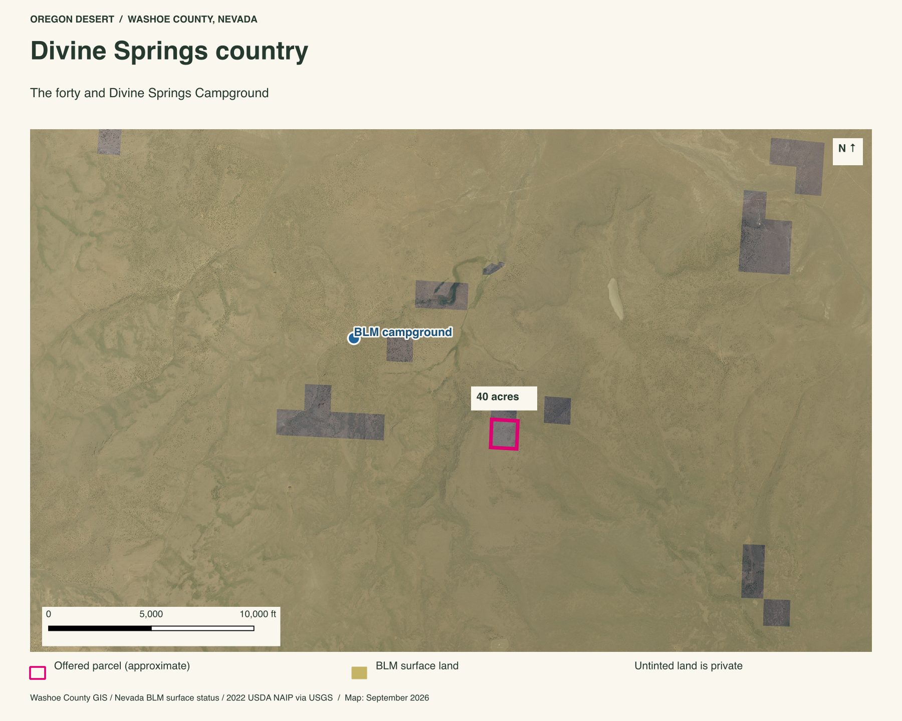
This is the draw for a land wanderer: forty acres to call your own, set in a much larger spread of public hills and draws. The close map shows BLM land to the south, east and west, with another private square to the north. The regional view opens that pattern out toward Divine Springs. You could spend years coming back to the same forty and still have new ground to study in the country around it.
Divine Springs Campground
The BLM's campground page lists five metal fire ring/barbecue pits and tables. A small stream runs through the campground behind a livestock fence. BLM lists hiking, horseback riding, biking, photography and wildlife viewing among the reasons to visit. The stream cuts a narrow green line through the open slopes. It is a place to camp, walk and begin exploring the BLM country around your own forty.
The campground point is about 1.5 miles northwest of the offered boundary in a straight line. The road is longer. BLM gives its driving directions from Cedarville through Eagleville and Hays Canyon Road on the visitor page. Start there for campground information, then talk with Peter about seeing the forty.
High Rock wildlands beyond the campground
Divine Springs is a small camp in a much larger wild-country story. The boundary of the Black Rock Desert-High Rock Canyon National Conservation Area begins about 12 miles away. BLM describes an 800,000-acre landscape of canyon, playa, hot springs, historic emigrant trails, wild horses and ten designated wilderness areas.
High Rock Canyon Wilderness begins about 15 miles from the forty. The BLM High Rock Canyon guide opens the door to the gorge, springs and old wagon route. The appeal here is the scale: private ground near a five-site streamside camp, with one of Nevada's largest protected backcountry landscapes beyond it.
Walk the rise
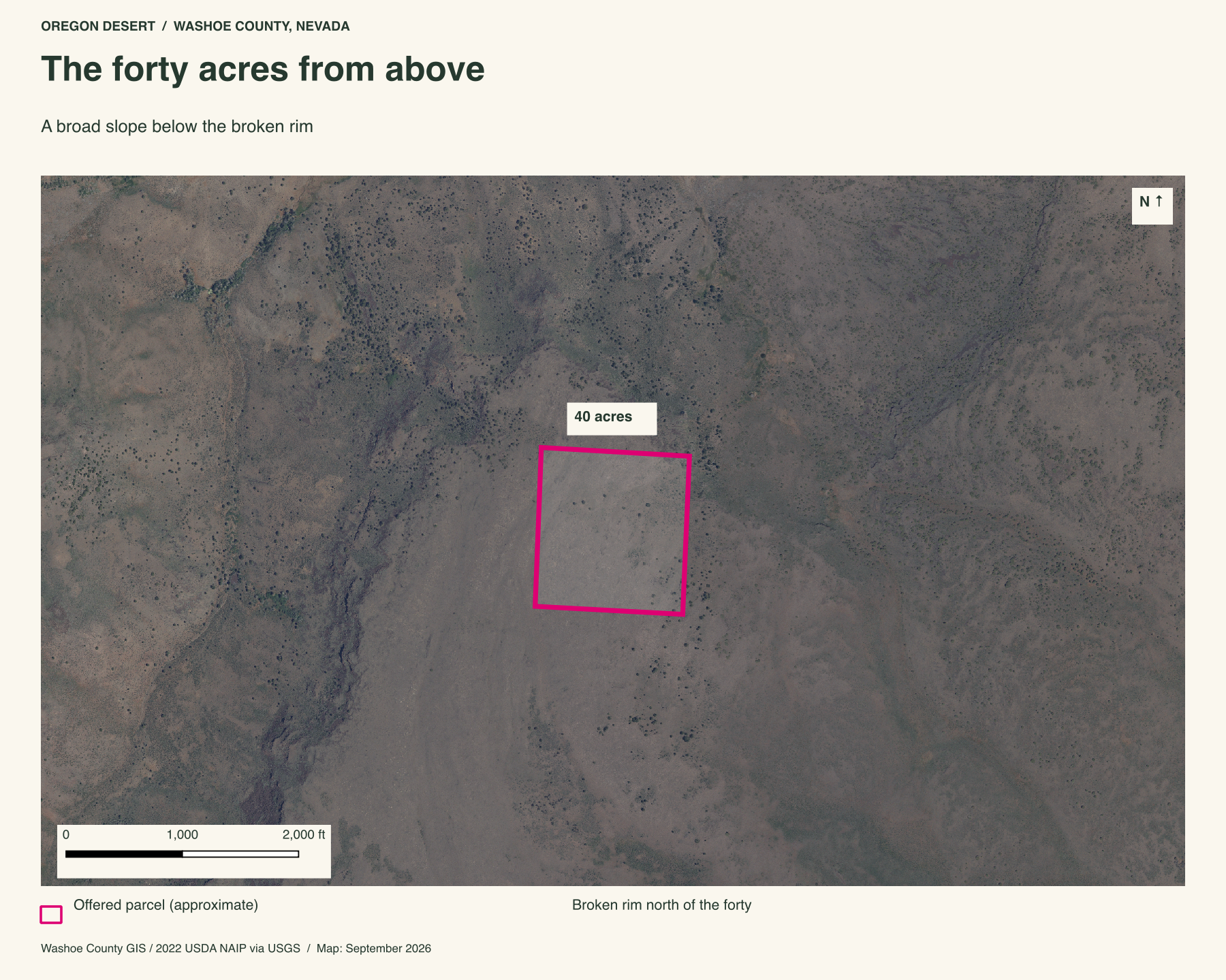
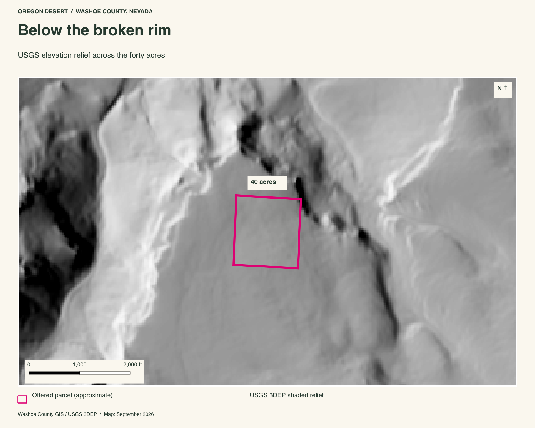
The close aerial shows how the forty rises toward the rim. USGS elevation sampling puts about 120 feet between its low and high ground. Sparse cover leaves the grade plain, while shaded relief picks out the draws beyond it. The slope gives you ground to climb and a different look back across the country from its upper side.
Property taxes and county records
Washoe County account 066-210-13
- Acreage
- 40 acres
- County parcel reference
- SE4 OF SE4, Section 34, T40 R19
- Discounted annual tax
- $21.44
- Record last updated
- 2026
Buyer due diligence
Before you buy
These listings and maps do not grant permission to enter any property or cross neighboring land. Visits to land offered for sale must be arranged with Peter in advance and use an authorized route. A sold listing is not an invitation to visit its current owner's land.
Buyers must independently verify recorded legal access and easements, road conditions and maintenance, water availability and water rights, well feasibility, power and other utilities, septic suitability, boundaries, title restrictions, and mineral rights.
Confirm zoning, permits, and whether your intended use is allowed with the county and relevant agencies, including building a home, camping, RV use, or renting to guests. Check flood and wetland restrictions and the cost of any improvements. A visible road, nearby power line, or mapped water does not establish a right to use it. Listing descriptions and maps are for general information and do not guarantee access, services, boundaries, or permission to build. Consult the county, utility providers, a title company, and qualified professionals before committing to a purchase.